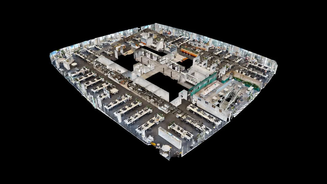
A design practice needed accurate existing-condition data for a CBD office floor before a renovation. The drawings were out of date, the space was partly furnished, and the tenancy stayed occupied during working hours, so the capture had to be quick, non-disruptive, and complete in one visit.
We captured the floor with a Lixel K2. Handheld SLAM suits a walkable, furnished interior far better than a tripod scanner that needs repositioning around every partition: the K2 records 200,000 points per second at walking pace, weighs roughly 1.2 kg, and builds the point cloud continuously as the operator moves, so occupants barely register that a survey is happening at all. Indoors there is no GNSS signal, which is precisely why SLAM matters here: the scanner localises itself from the geometry it sees, no satellites required.
One afternoon, and no desks moved
The brief was as much about disruption as about data. A tripod survey of the same floor would have meant a setup roughly every partition, staff asked to step away from desks repeatedly through the day, and a floor manager fielding questions about it. A single walking pass took an afternoon and drew no attention beyond a few curious glances.
- Captured during working hours, tenancy fully occupied
- No furniture moved and no areas closed off
- Processed the same day, so gaps were found while access was still open
- The practice keeps every file we delivered
One walk, planned in advance
The capture came down to a planned single loop:
- Plan. Map a continuous walking route that closes loops through corridors and rooms; flag glass, mirrors, and tight spaces.
- Capture. Walk the floor at a steady pace, keeping overlap through doorways and returning to the start to close the loop.
- Process. Run the capture through LixelStudio to register and clean the point cloud on the same day.
- Export. Deliver LAS, E57 and RCP for the design and BIM environment, plus a coloured cloud for review.
The walk plan is where interior captures are won. A SLAM trajectory accumulates small positional errors as it goes; every time the route returns through a space it has already scanned, the software recognises the repeated geometry and corrects the drift. So we drew the route as a loop rather than a dead-ended sweep: down one side of the floor, through the meeting rooms, back along the opposite side, and home to the start point for the final closure. Doorways get a moment of deliberate overlap, entering, letting the sensor see both rooms, then proceeding, because thresholds are where two spaces knit together in registration. Small rooms are taken as short in-and-out detours off the main loop rather than as separate scans, keeping the whole floor in one continuous trajectory.
How long does an office floor take to scan?
A single tenancy floor of a few hundred square metres is a short capture once access is arranged, with processing the same day. Larger or cluttered spaces take proportionally longer and may need multiple loops. The practical constraint is rarely the scanner, which runs roughly 90 minutes per hot-swappable battery and stores captures to 512 GB onboard, but access: agreeing a window when desks are clear enough to walk and occupants are not mid-meeting. Same-day processing means we verify the data is complete while the access window is still open, which is the correct moment to discover a missed store room, not a week later.
Processing, same day
Back at the desk the workflow is deliberately boring: import the raw capture, run the SLAM optimisation so the loop closures tighten the trajectory, review the colourised cloud for gaps or ghosting, crop to the tenancy boundary, and filter the stray points that moving people and reflective surfaces contribute. Then the exports, one per audience: LAS as the archival dataset, E57 where a consultant on other software needs a vendor-neutral copy, and RCP so the cloud drops straight into Revit or AutoCAD as a reference layer for the renovation model.
What the practice walked away with
Typical outputs from an interior capture like this:
- Registered point cloud: a measurable coloured cloud of the floor (LAS / LAZ / E57 / RCP) for reference in Revit, AutoCAD, or CloudCompare.
- Scan-to-BIM reference: a reference layer to model existing conditions against.
- Mesh for review: a lightweight mesh for quick visual review and coordination with stakeholders.
Planning around the hard parts
Interiors have predictable failure modes. Glass and mirrors confuse any SLAM device, laser pulses pass through or bounce off them, producing phantom geometry behind the pane, reflective floors add noise, and a furnished space hides surfaces you will want later. The mitigations are technique, not equipment: walk oblique angles past glazing rather than facing it square-on, note mirror positions on the walk plan so their artefacts can be cropped in processing, and photograph anything furniture conceals. Booking access during quieter hours and planning the route up front prevents most re-scans. And to be clear: these are reference workflows, not certified survey deliverables.
- Glass, mirrors, and glossy floors need careful technique
- Occupied spaces may require after-hours or weekend access
- Tolerance-critical work: we agree expectations before capture
- Reference workflow, not a certified survey deliverable
Have a floor like this?
The same approach fits any occupied interior: offices, retail, hospitality, anywhere you cannot close the space to survey it. See where else it applies on interiors and renovation, read what as-built documentation covers, or send the floor area, access window and intended output. We reply with scope and a quote within one business day.

