Cadastral and boundary survey, by a Registered Surveyor.
Where your boundary legally sits, marked on the ground and certified with SLA by our partner Registered Surveyor, with the site, walls and structures around it captured by LiDAR. One team, one quote.
 Boundary survey in the field
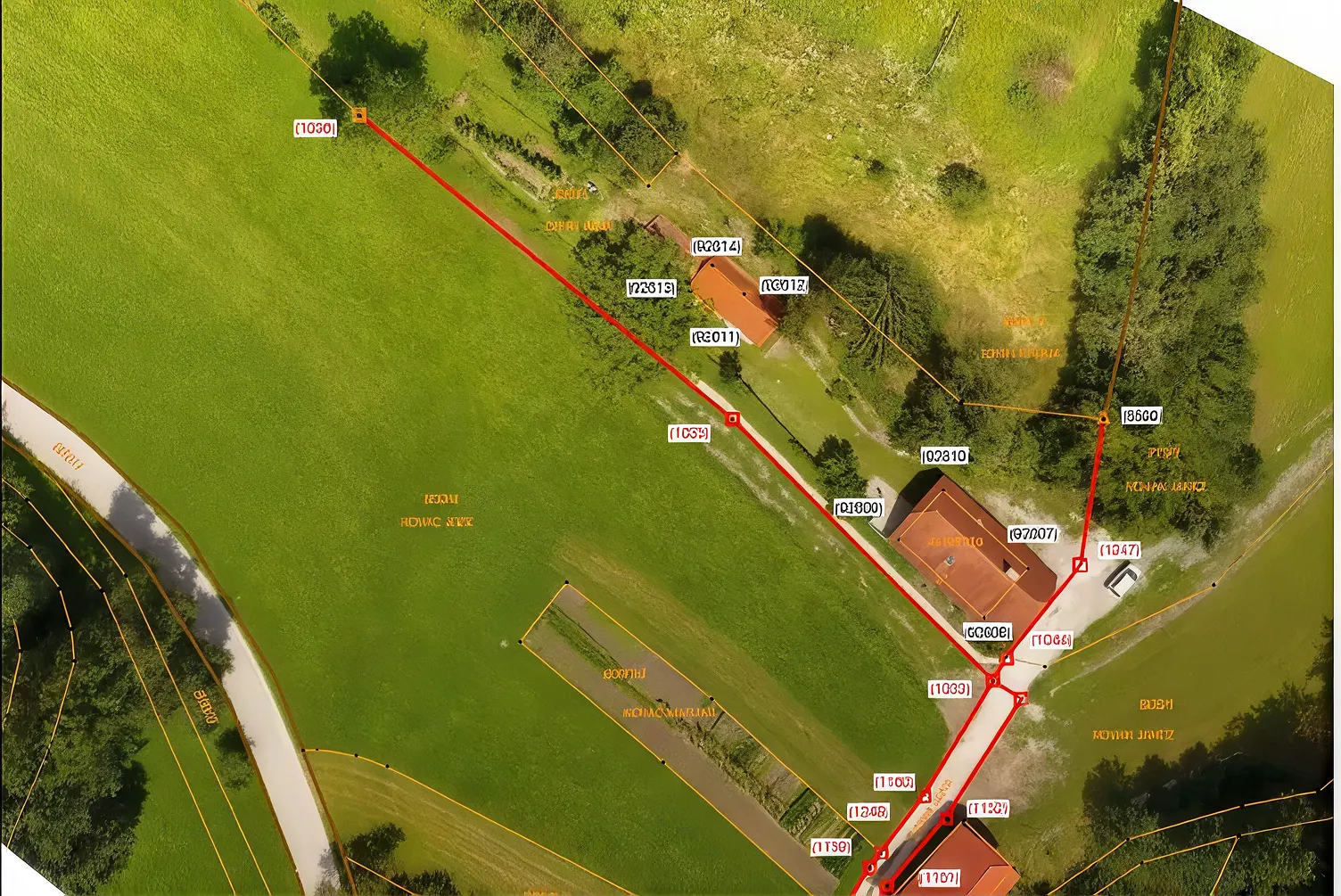 Boundary lines on the site
What a cadastral survey is
A cadastral survey fixes where a property’s legal boundaries are. The land surveyor determines the boundary lines, marks the boundary points on the ground and records them on a certified plan that becomes part of Singapore’s cadastre, the official record of every land and strata lot. Singapore’s cadastre is coordinated: since 2004 boundaries are defined by approved coordinates, so a boundary can be re-established precisely even where a mark has been lost.
A measured survey tells you where things are. A cadastral survey tells you where the property ends, and only the second one carries legal weight. That is why the two are done by different people.
When you need one
- Rebuilding or extending a landed house, where the new walls, setbacks and boundary wall have to sit on the right side of the line.
- Boundary wall disputes with a neighbour, or a fence, drain or structure suspected of crossing the line.
- Missing or disturbed boundary marks, often after earlier works on either side.
- Subdividing or amalgamating land, where new lots need new boundaries. For strata lots inside a building, see strata subdivision.
- Buying, selling or financing a property whose boundaries are in doubt.
Who is allowed to do it
SLA is explicit: a property owner has to engage a practising Registered Surveyor to carry out a property boundary survey, and the Registered Surveyor then deals with SLA on the owner’s behalf. Registered Surveyors are registered under the Land Surveyors Act and listed by the Land Surveyors Board. No one else, however well equipped, can certify a boundary.
Boundary marks and certified plans
On a cadastral survey the Registered Surveyor determines the boundaries and marks the boundary points on the ground. On completion, the surveyor deposits a certified plan with the survey documents at SLA for inspection against the Chief Surveyor’s directives. Once accepted, the certified plan and its coordinates are the record of where the boundary is. Boundary marks are protected by law: they should not be moved or removed, and a disturbed mark is a job for a Registered Surveyor, not a contractor.
What Volumet adds
A boundary survey answers where the line is. The next question is usually what sits near it: the boundary wall, a neighbour’s eaves, a drain, a retaining wall, the building you are about to extend. We capture the site and everything along the boundary withLiDAR, and the Registered Surveyor’s boundary lines are placed on that capture. The result shows, to the centimetre, how close each structure is to the line, which is what an architect or a dispute actually needs.
The same capture gives the architect atopographical survey and the building team a baseline for setting out, so one visit serves the whole project.
Volumet and the Registered Surveyor
Volumet is not a Registered Surveyor. The statutory part of this work is carried out, signed and lodged by a Registered Surveyor registered under the Land Surveyors Act, from a surveying firm we partner with. We capture and measure, run the job and give you one point of contact and one quote.
Cost drivers
Price follows the number of boundary points and lots, whether existing marks can be found or have to be re-established, access along the boundary, and how much of the site is captured by LiDAR alongside. SLA’s fees are passed through as disbursements. Send the address and lot number toget a quote.
From site capture to certified plan.
Lot number, existing certified plans and the reason for the survey reviewed.
The Registered Surveyor surveys and marks the boundary points.
Volumet captures the site and every structure along the boundary.
The Registered Surveyor prepares and deposits the certified plan with SLA.
Certified plan, boundary coordinates and the capture with the lines on it.
Priced per lot.
One quote covers our partner Registered Surveyor's cadastral survey and certified plan, and our LiDAR capture of the site. We come back within one business day.
- Address and lot number
- Reason for the survey
- Any existing certified plan
- Number of boundary points and lots
- Whether marks must be re-established
- Access along the boundary
- How much of the site we capture alongside
SLA's fees are separate and listed as disbursements.
This one depends on the site, so we price it from the details. Send them and we come back within one working day.
Priced case by case once we have the site details.
What the owner receives.
| Deliverable | Prepared by | Use |
|---|---|---|
| Certified plan | Partner Registered Surveyor | The legal record of the boundary, lodged with SLA |
| Boundary marks | Partner Registered Surveyor | Boundary points marked on the ground |
| Boundary coordinates | Partner Registered Surveyor | Coordinates of each boundary point |
| Site capture with boundary overlay | Volumet | Structures near the line, measured; E57, DWG, PDF |
Based on SLA’s guidance on property boundary surveys. The certified plan is prepared and signed by the Registered Surveyor, not by Volumet.
Related work, services and guides.
Common questions.
What is a cadastral survey?
A survey that determines where a property's legal boundaries are, marks them on the ground and records them on a certified plan in Singapore's cadastre. It is the survey with legal weight, as opposed to a measured survey of what is on the site.
Who can carry out a boundary survey in Singapore?
Only a practising Registered Surveyor. SLA asks property owners to engage one, and the Registered Surveyor deals with SLA on the owner's behalf. Our partner surveying firm's Registered Surveyor carries out and certifies the survey; Volumet captures the site and runs the job.
Is Volumet a land surveyor?
Volumet is not a Registered Surveyor. We are a measurement company that works with partner Registered Surveyors, so you can get the cadastral survey and the site capture from one team with one quote.
When do I need a property boundary survey?
When rebuilding or extending near the boundary, when a boundary wall or structure is disputed, when boundary marks are missing or disturbed, when land is subdivided or amalgamated, or when a sale depends on where the boundary is.
What is a certified plan?
The plan a Registered Surveyor deposits with SLA after a cadastral survey. Once SLA accepts it, it and its boundary coordinates are the record of where the boundary is.
A boundary mark is missing. Can it be replaced?
Yes, by a Registered Surveyor. Singapore's cadastre is coordinated, so a boundary point can be re-established from its approved coordinates. A contractor should not move or replace a boundary mark.
Can you show whether my neighbour's wall is over the line?
Yes. The Registered Surveyor fixes the boundary, and our LiDAR capture of the wall is overlaid on it, showing how far each part of the wall is from the line.
What does SLA charge?
SLA's fees are separate from ours and depend on the survey. They are listed in the quote as disbursements.