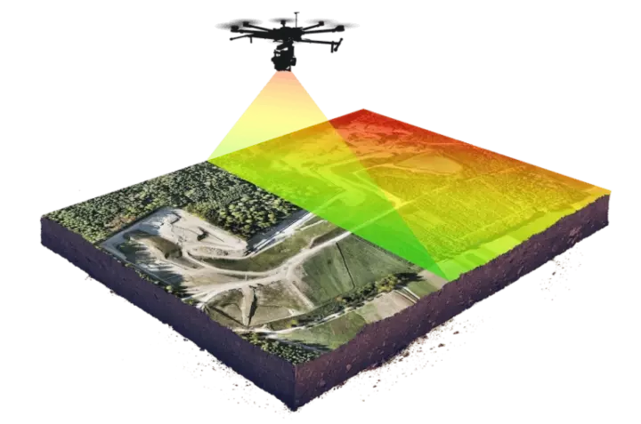
 Aerial survey · M350 RTK
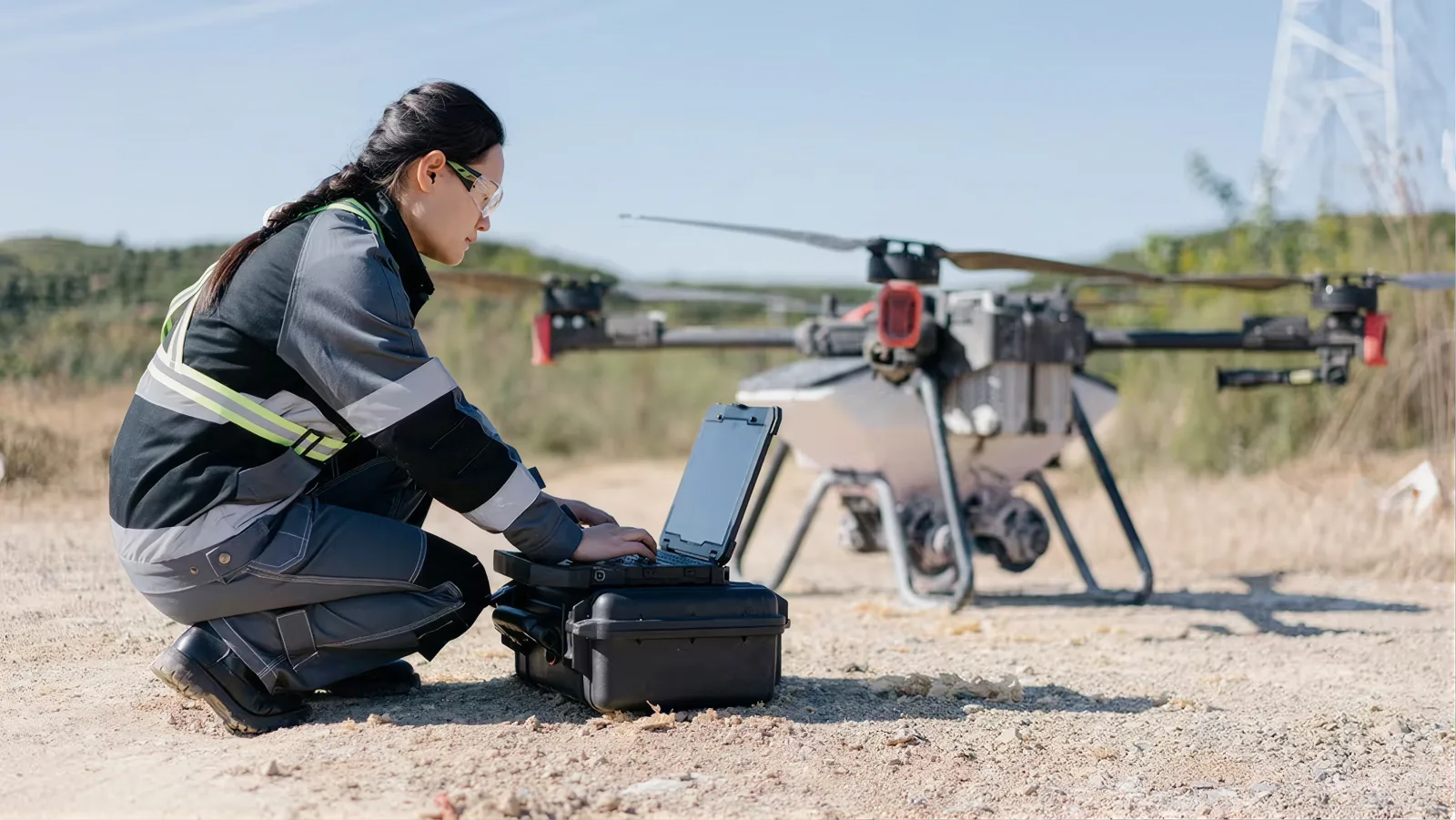 Pre-flight · survey drone
Aerial mapping, photogrammetry and airborne LiDAR for sites, roofs and structures ground capture cannot see: flown on the DJI Matrice 350 RTK under CAAS permits, delivered as orthomosaics, DSM/DTM and point clouds.
Aerial survey · M350 RTKPre-flight · survey droneOrthomosaics for plan-view measurement and record; digital surface and terrain models for levels, drainage and volumes; aerial point clouds from the Zenmuse L2 LiDAR payload or photogrammetry; and inspection imagery of roofs, facades and structures. Aerial data merges with ground capture from 3D laser scanning into one registered dataset when a project needs both.
Delivered with it: the flight record, the control used, the coordinate system, GSD or point density achieved, and a coverage note. Aerial deliverables without that metadata are pictures; with it, they are survey products your engineer can rely on.
Commercial drone operations in Singapore require CAAS permits and licensed pilots, and much of the island sits under airspace restrictions. Some sites cannot be flown; some need additional clearances and lead time. We check every site against current restrictions before quoting, and tell you plainly when aerial capture is not available, rather than discovering it after mobilisation. Where a facade cannot be flown, ground-based long-range scanning is often the substitute.
Practical consequences for your programme: permit lead time is part of the schedule, not an afterthought; a site near an aerodrome, a protected installation or a dense residential cluster may be refused or restricted to specific windows; and consent from the site owner or manager is separate from regulatory permission. We ask for both early because they are the two things that delay flight days.
Photogrammetry builds geometry from overlapping images. It is excellent on hard surfaces, gives true-colour orthomosaics, and is the cheaper option on open ground. It struggles with vegetation, water, uniform textures and thin structures, and it cannot see the ground under a canopy.
Airborne LiDAR measures directly with a laser and penetrates gaps in vegetation, so it produces a usable terrain model where photogrammetry produces a green blanket. It handles thin linear features, railings, cables, poles, that images smear. It costs more per hectare and its colour comes from a separate camera pass.
The choice is usually decided by two questions: is there vegetation you need to see through, and does the deliverable need to be a terrain model or a picture? Vegetated or terrain-critical sites go LiDAR; clean hardstanding and record imagery go photogrammetry; many sites take both in a single mobilisation.
Centimetre-class accuracy is achievable with ground control and RTK/PPK, and the figure that matters is the one measured on your site, not the one on a brochure. What moves it: flight altitude and overlap, GSD, the quality and distribution of ground control, terrain and vegetation, GNSS conditions on the day, and how the processed data is checked against independent points.
So every quote states the target accuracy with its conditions, and every delivery reports what was achieved and how it was verified. Where a project needs absolute positioning tied to a site grid or an existing survey, control is set and recorded before the first flight.
Aerial capture sees roofs and terrain; ground capture sees interiors, undersides and vertical detail. Most real sites need both, so we register them together against shared control and deliver one coherent dataset rather than two files that nearly line up. A common pattern: LiDAR flight for terrain and roof, tripod stations for the facade bays that will be dimensioned, handheld SLAM for the interiors: one coordinate system, one delivery.
Site brief and risk assessment; permit and consent check; control established or verified; take-off and landing zones agreed with the site; flights executed to plan with battery cycles built in; data verified on site before demobilisation, coverage, exposure, LiDAR trajectory quality, because returning is expensive. Processing follows off site: georeferencing, point cloud generation or image alignment, classification where the deliverable needs bare earth, and a check pass against control.
What drives cost: site area and shape, the number of separate flights or days needed, permit complexity, payload (LiDAR costs more than a camera), accuracy specification and the amount of control required, and processing depth: a raw ortho is quick, classified bare-earth terrain models are not. Repeat monitoring flights price lower per visit than a one-off because planning, control and permits are already in place.
Typical timing: a small site is a single day on site with deliverables within a week; larger or multi-payload jobs are phased. Send the site and the deliverable to get a quote: permit lead time is included in the schedule we return.
Aerial work has a longer runway than ground capture, and almost all of it is administrative. To quote accurately we need the site boundary, a KML, a marked-up plan or even a clear map screenshot, the deliverable you actually need, the accuracy or datum requirement if there is one, and your target window. To fly, we need the site owner or manager’s consent, contact details for whoever controls access, and any site-specific safety or induction requirements.
Useful to send if it exists: previous survey data or control we can tie into, a design surface if volumes are to be compared against it, and any known constraints: neighbouring installations, event dates, crane operations, restricted hours. Crane and lifting activity in particular determines flight windows, and finding out on the day costs a mobilisation.
What we handle: airspace screening, CAAS permitting and the lead time it carries, flight planning, control, capture and processing. What we cannot handle is a refusal, if a site sits under a restriction that will not be cleared, we say so before quoting and propose ground-based capture instead, usually long-range scanning from accessible vantage points.
Realistic planning rule: treat permitting as the critical path, not the flight. Sites with straightforward airspace move quickly; anything near sensitive infrastructure should be raised weeks rather than days before the date you want.
Single flights answer a question. Repeat flights answer an argument. On any site where earth moves, material is stockpiled or progress is claimed, a monthly aerial record becomes the reference both sides use, and the value compounds because each visit is measured against identical control and an identical base surface.
Setting a cadence is a programme decision rather than a survey one. Earthworks-heavy phases justify monthly or fortnightly capture; structural phases often need only monthly progress imagery; fit-out phases are better served from the ground. We would rather set a cadence that matches the phase than sell twelve identical flights.
What monitoring delivers on each cycle: an orthomosaic for the record, a surface comparison against the previous visit and against the design surface, volume movements with the base surface stated, and a short note of anything the imagery shows that the numbers do not: drainage ponding, encroachment, stockpiles sited where they should not be. Those observations are frequently worth more than the volumes.
Because control, permits and flight plans are already established, each subsequent visit is faster and cheaper than the first. That is the practical argument for committing to a monitoring programme rather than commissioning ad hoc flights: the first flight carries the setup cost, and every one after it benefits from it.
Location screened against current restrictions; permit route and lead time confirmed before quoting.
CAAS permitting and site-owner consent secured; flight windows agreed.
Ground control established or verified where absolute accuracy is required.
Planned missions on the M350 RTK with the LiDAR or camera payload; data verified before leaving site.
Georeferencing, point cloud or ortho generation, classification, control check, then delivery with the flight record.
| Deliverable | Format | What it answers |
|---|---|---|
| Orthomosaic | GeoTIFF · PDF | Scaled plan-view record and measurement |
| Digital surface model (DSM) | GeoTIFF | Surface levels including vegetation and structures |
| Digital terrain model (DTM) | GeoTIFF · DWG contours | Bare-earth levels for drainage and earthworks design |
| Aerial point cloud | LAS / LAZ · E57 | Geometry for design, volumes and merging with ground scans |
| Volume computations | PDF · XLSX | Cut-and-fill and stockpile quantities, repeatable month to month |
| Inspection imagery | JPEG · PDF report set | Roof, facade and structure condition evidence |
| 3D mesh / model | OBJ · glTF | Visualisation and context models |
| Flight and control record | Coverage, GSD or point density, control, achieved accuracy |
Where a site cannot be flown, we say so before quoting and propose ground-based capture instead.
Commercial operations require CAAS permits and licensed pilots. Each flight is planned against current airspace restrictions, and permit lead time is built into the quote.
Orthomosaics, DSM/DTM, aerial point clouds and inspection imagery, in GeoTIFF, LAS/LAZ or E57 to suit your tools.
Centimetre-class with ground control and RTK/PPK. The achievable figure depends on flight parameters, control and terrain: stated with conditions in the quote and reported against control on delivery.
No. Restricted airspace covers much of the island. We verify the site first and say plainly when it cannot be flown.
LiDAR where vegetation must be seen through or a bare-earth terrain model is the deliverable. Photogrammetry where the site is open hardstanding and true-colour record imagery matters. Many sites take both in one mobilisation.
Yes, and it usually should be. Both are registered against shared control and delivered as one dataset: roofs and terrain from the air, interiors and vertical detail from the ground.
On whatever cadence the programme needs, monthly being the common one. Repeat visits price lower than one-offs because control and permits are already in place.
We fly the imagery. A facade inspection itself is a statutory act with defined roles: see facade inspection support for exactly where the boundary sits.
Indoor flight is a different risk profile and is assessed case by case. In most interiors handheld SLAM is the better tool, faster, safer and GNSS-independent, so we usually propose ground capture instead.
Rain, low cloud and strong or gusting wind. Singapore’s afternoon convection means morning windows are more reliable, and monsoon periods need contingency dates built into the programme. We rebook rather than fly marginal conditions.
Yes: contours from the terrain model, and volumes as a difference against a stated base or design surface. Vegetated sites need LiDAR rather than photogrammetry for the terrain model to be usable.
Yes. Commercial operations carry the required insurance, and we issue a method statement and risk assessment for the site’s records before mobilisation.