Tree surveys for NParks submissions.
Every tree on the site located and measured by LiDAR, the survey plan endorsed by our partner surveyor and each tree assessed by a certified arborist, so the tree plan, the tables and the site agree.
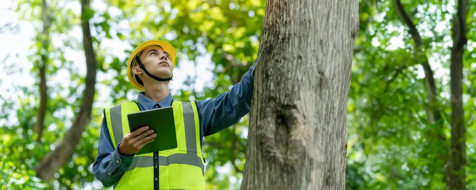 Every tree recorded
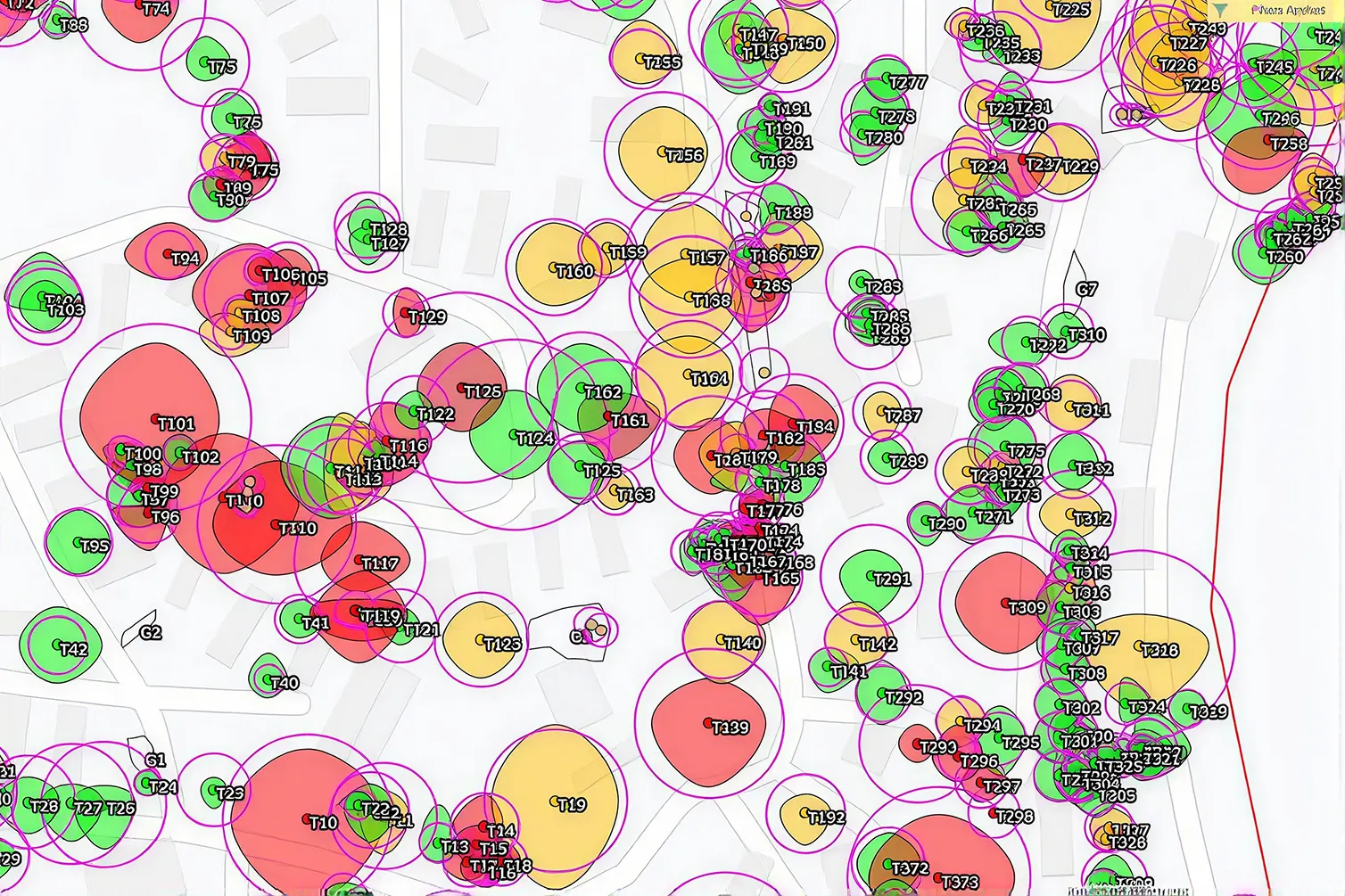 Tree plan with IDs and crowns
When NParks needs to know
Singapore protects mature trees in two places. In the Tree Conservation Areas, gazetted on 2 August 1991, and on vacant land, any tree with a girth of more than 1.0 m, measured 1.0 m above the ground, may only be felled with the written approval of the Commissioner of Parks and Recreation, even when no development is under way. On a development site, the trees go into the plans submitted to NParks, and the design has to show which are kept, which are removed and how the kept ones are protected.
What the submission needs
NParks’ development submissions include a survey plan, surveyed less than two years before the application and endorsed by a qualified surveyor (it does not apply to A&A proposals). Each tree carries an ID that matches the QP’s plans, and a tree summary table gives its species, girth, height, the recommended Tree Protection Zone and the Certified Arborist’s recommendation to retain or remove it, with the reasons. On the layout plan, retained trees are shown in green with their protection zone dimensioned, and trees proposed for removal in yellow.
Measuring trees by LiDAR
Tape and clinometer work tree by tree. A LiDAR capture of the site, on foot under the canopy and bydrone above it, records every tree at once: its position on SVY21, the girth at 1.0 m taken from the trunk in the point cloud, its height and crown spread. The tree IDs, table and plan are all produced from the same data, so they cannot disagree, and a tree queried later can be measured again without a site visit. For multi-leader and low-branching trees, where NParks measures girth differently, the arborist confirms the measuring point.
Tree Protection Zones
NParks’ guideline sets a minimum Tree Protection Zone by girth, and advises engaging a Certified Arborist to recommend it, since a larger zone may be needed for a big crown or root spread:
| Girth | Minimum Tree Protection Zone |
|---|---|
| Up to 1.0 m | 2.0 m |
| Over 1.0 m to 1.5 m | 3.0 m |
| Over 1.5 m to 2.0 m | 4.0 m |
| Over 2.0 m | 5.0 m |
Because the capture holds the whole site, each zone can be checked against the proposed building, basement and hoarding lines before the plans go in.
Who does what
Volumet is neither a surveyor nor an arborist. The survey plan is endorsed by a qualified surveyor, and species identification, tree assessment and retention recommendations are made by a Certified Arborist, both from firms we partner with. We capture and measure the trees, produce the plan and tables, and run the job, so you have one point of contact and one quote.
Cost drivers
Price follows the site area, the number of trees, how dense the vegetation is, whether a full arborist assessment is needed for every tree or only for those affected by the works, and access. Send the site plan and an idea of the tree count to get a quote.
Every tree, measured once.
Site extent, NParks requirements and the trees affected by the proposal agreed.
Volumet captures the site on foot and by drone.
Each tree tagged with position, girth at 1.0 m, height and crown spread.
The Certified Arborist identifies species and recommends retention or removal.
The survey plan endorsed by the partner surveyor, ready for the QP.
Priced per site.
LiDAR measurement, the partner surveyor's endorsement and the Certified Arborist's assessment, in one quote. We come back within one business day.
- Site plan
- Rough number of trees
- Whether the site is in a Tree Conservation Area
- Number of trees
- Vegetation density
- Arborist assessment for every tree or only affected ones
- Site access
A landed plot with a few mature trees is quick; a vegetated site with hundreds of trees is a larger survey.
This one depends on the site, so we price it from the details. Send them and we come back within one working day.
Priced case by case once we have the site details.
What the QP receives.
| Deliverable | Prepared by | Use |
|---|---|---|
| Endorsed survey plan | Partner surveyor | Surveyed within two years, for the NParks submission |
| Tree summary table | Volumet with the Certified Arborist | ID, species, girth, height, TPZ and recommendation |
| Arborist recommendations | Partner Certified Arborist | Retention or removal, with justification |
| Tree layout plan | Volumet | Retained trees in green with TPZ, removals in yellow; DWG and PDF |
| Registered point cloud | Volumet | Every tree, re-measurable later; E57 or LAS |
Requirements from NParks’ Guidelines on Greenery Provision and Tree Conservation for Developments. Check NParks’ current version before a submission.
Related work, services and guides.
Common questions.
When do I need NParks' approval to cut a tree?
When the tree has a girth of more than 1.0 m, measured 1.0 m above the ground, and grows in a Tree Conservation Area or on vacant land. Written approval from the Commissioner of Parks and Recreation is needed, even if no development is in progress.
What is a tree survey plan?
A plan of the trees on a site, with an ID for each that matches the QP's plans, supporting a development submission to NParks. NParks asks for a survey plan surveyed less than two years before the application and endorsed by a qualified surveyor.
Is Volumet an arborist?
No. Species identification, tree assessment and retention recommendations are made by a Certified Arborist from a firm we partner with, and the survey plan is endorsed by a partner surveyor. Volumet measures the trees and produces the plan and tables.
How is girth measured?
Generally 1.0 m above the ground. Multi-leader and low-branching trees are measured at different points under NParks' guideline, which the arborist confirms.
What is a Tree Protection Zone?
An area around a retained tree kept free of works. NParks' guideline sets a minimum by girth, from 2.0 m for trees up to 1.0 m girth to 5.0 m for trees over 2.0 m, and a Certified Arborist may recommend more.
Why use LiDAR for trees?
It measures every tree's position, girth, height and crown spread in one capture, so the plan and the tables come from the same data and can be re-checked without going back to site.
Does an A&A project need a tree survey plan?
NParks' survey plan requirement does not apply to A&A proposals, but trees near the works may still need protection. Tell us the scope and we will say what applies.