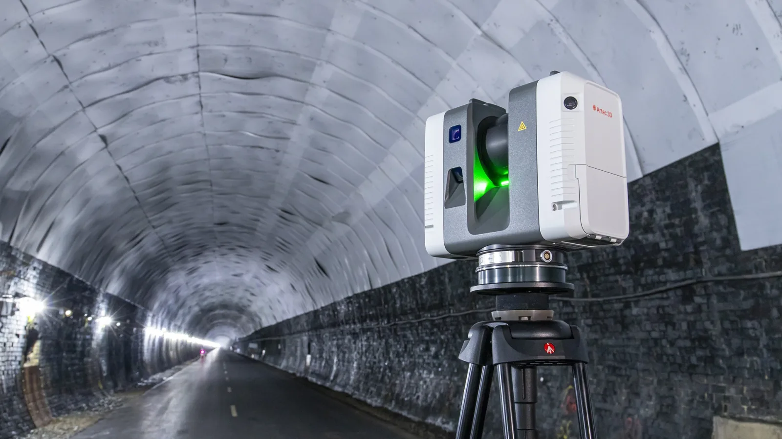
 Interior capture · handheld SLAM
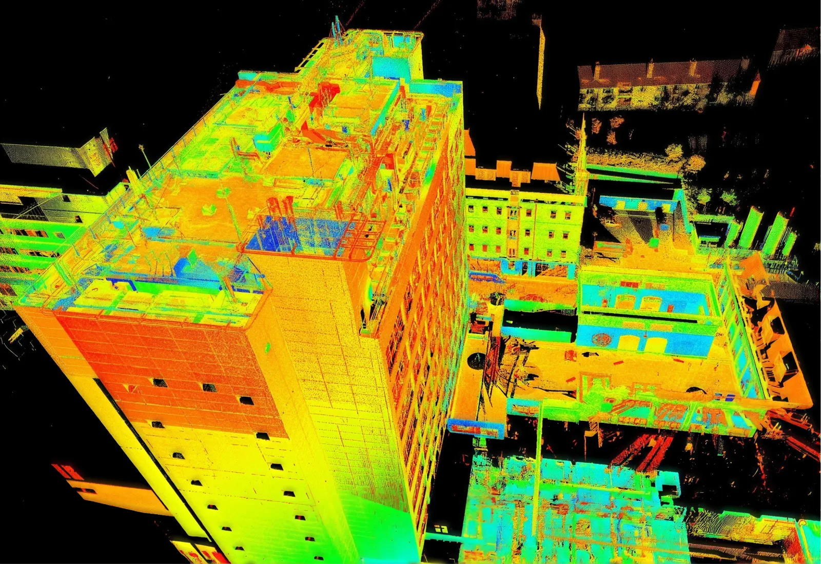 Registered point cloud
We scan buildings and sites into registered point clouds: delivered in E57, LAS/LAZ or RCP, captured in hours, processed within days. Handheld SLAM for occupied spaces, tripod scanning where accuracy governs, and both on the same job when the project needs it.
Interior capture · handheld SLAMRegistered point cloudA registered, quality-checked point cloud of the building or site as it stands, in the format your tools read: E57 as the vendor-neutral default, LAS or LAZ for survey and GIS workflows, RCP/RCS for Revit and AutoCAD. Optional extras: mesh (OBJ/FBX/glTF), colourised output, and 3DGS scenes from compatible captures. Whole-building captures run to tens of gigabytes: we agree the delivery arrangement up front rather than emailing you a link that fails.
Alongside the cloud you get the things that make it usable six months later: a scan coverage note saying what was captured and what was not, the registration report, the coordinate system and units, and, where control was set, the control record. A point cloud without that context is a liability the next consultant has to re-do.
The honest trade-off: handheld SLAM wins on speed and access, tripod scanning wins on accuracy per station. An occupied office floor cannot be closed for tripod stations: the Lixel K2 captures it in a walk-through at 200,000 pts/s. Statutory or dispute-grade measurement wants the BLK360 G2’s 4 mm @10 m. Long corridors and external sightlines beyond 100 m call for the Lixel L2 Pro, which holds ≤1 cm relative within 100 m and reaches 120 m as standard. Most real projects combine methods, and combining them on one job is normal rather than a compromise.
A typical mixed job looks like this: handheld capture for the circulation, tenanted floors and back-of-house, tripod stations on the elements a drawing will be dimensioned from, grid lines, structural faces, lift cores, a facade bay, and the two datasets registered together against the same control. You pay for tripod time only where tripod accuracy earns it.
Relative and absolute accuracy are different things, and conflating them is the most common way scan data disappoints. Relative accuracy is how correct a measurement is within the scan: the distance between two walls. Absolute accuracy is how correctly the whole scan sits in real-world coordinates. A device can be 1 cm relative and 3 cm absolute, and for many jobs only the first number matters. If your deliverable has to tie into a site grid, a Singapore coordinate system or a neighbouring survey, say so in the brief, that is an absolute-accuracy job and it changes how we set up.
Tripod accuracy is per station. The figure you actually get across a building depends on how well stations are registered together, so we quote the instrument figure with its condition attached and report the achieved registration afterwards. We do not publish a single flattering number and hope nobody checks it.
Worth knowing before you book, because it is what moves a half-day job to a full day. Mirrored and glazed surfaces return misleading points and need either avoidance or cleanup. Dense storage, stacked furniture and cable-tray congestion mean the scanner cannot see what is behind them, so occupied storerooms give partial data by definition. Long featureless corridors are hard for SLAM to hold onto; we plan loop closures through them rather than walking them once. Live traffic, forklifts and public circulation add passes. And splitting a building across several tenancies with separate approvals adds coordination time that has nothing to do with scanning.
Raw scans are not a deliverable. Every job goes through registration: aligning individual scans or SLAM trajectories into one coordinate system: followed by a check pass: cloud-to-cloud residuals, loop-closure checks on handheld data, control residuals where control exists, and a coverage review against the scope list. We remove obvious noise, stray people and vehicle passes, and confirm the file opens in the target software before it leaves. If a spec was not met, you hear it from us with the numbers, not from your modeller three weeks later.
Capture once, answer repeatedly. The same registered cloud is the source dataset for as-built drawings, for a Scan-to-BIM model at an agreed LOD, for a digital twin handover package, and for clash and fit checks your team runs directly in the cloud. Questions nobody thought to ask on the day are already answered in the data, so a second mobilisation is rarely necessary. It is also why we archive the registered dataset: the cheapest survey is the one you already own.
Capture is typically hours on site; processed deliverables for a normal floor plate arrive within a week. What moves the price: floor area and site extent, the number of separate spaces and tenancies, access and out-of-hours constraints, the accuracy specification (control and tripod work cost more than a walk-through), and the deliverables list. Repeat capture on a schedule, monthly progress records, for instance, prices differently from a one-off because the setup is already done.
Send the brief to get a quote: the address or drawing extent, the accuracy you need, the formats your team works in, and the date. We respond within one business day.
Three situations where we will tell you to spend the money elsewhere. First, when the official drawing already exists and is current: buying it is cheaper than measuring, and the BCA plan purchase guide explains the route. Second, when the question is about a single dimension in a single room: a tape measure and a photograph answer that, and paying for mobilisation, registration and QA to confirm one opening width is not good value. Third, when the real requirement is a legal boundary, that is a Registered Surveyor’s statutory work, and no amount of point-cloud density changes it: see land survey for where the line sits.
Conversely, scanning earns its cost quickly in four cases: the building has been altered and no drawing matches it; several deliverables will come from one visit, so the capture is amortised; the space is complex, irregular or occupied enough that hand measurement would be slow and error-prone; or the record needs to be defensible later, because a registered cloud can be re-measured by anyone, years afterwards, without a site visit.
We would rather tell you which category you are in during the first conversation than sell a capture that does not pay for itself. Send the question rather than the specification, and we will say which route is cheapest.
Scope, accuracy target, formats and access constraints agreed in writing before a date is held.
Where the cloud must sit in real-world coordinates, control is established and recorded first.
Handheld SLAM, tripod stations or both. Hours on site for a normal floor plate; occupied buildings are routine.
Scans registered, residuals and coverage checked, noise and passers-by cleaned out.
Files in your formats with a coverage note and registration report. The dataset stays archived for later questions.
Name the tool your team works in and we deliver to it. If your downstream software is unusual, say so in the brief and we confirm compatibility before capture.
| Format | What it is | Who asks for it |
|---|---|---|
| E57 | Open, vendor-neutral point cloud exchange standard | The safe default; almost everything reads it |
| LAS / LAZ | ASPRS LiDAR standard; LAZ is losslessly compressed LAS | Survey and GIS workflows. Same data, LAZ is far smaller |
| RCP / RCS | Autodesk ReCap project and scan files | Anyone working in Revit or AutoCAD |
| PTS / PTX | Simple ASCII point formats | Legacy tools, or when nothing else is accepted |
| OBJ / FBX / glTF | Mesh formats derived from the cloud | Visualisation, XR, games and media pipelines |
| DWG / DXF | 2D drawings cut from the cloud | Delivered through as-built documentation |
| RVT / IFC | Modelled building elements | Delivered through Scan-to-BIM |
File sizes are worth planning for: a whole-building capture runs to tens of gigabytes, which affects how delivery is arranged.
It depends on the instrument and the conditions. Tripod scanning on the BLK360 G2 captures at 4 mm @10 m per station, with absolute accuracy dependent on how stations are registered together. Handheld SLAM on the Lixel K2 is ≤1 cm relative within 10 m, and ≤3 cm RMSE absolute with RTK. Every quote states the figure with its condition attached.
No. Handheld SLAM works in occupied buildings: offices and venues in use are routine. Movement adds cleanup time, not risk to the result.
No. LiDAR does not need ambient light; only colourised output benefits from it. Clients assume otherwise often enough that it is worth saying plainly.
E57 by default; LAS/LAZ, RCP/RCS, PTS/PTX, and mesh formats on request. If your downstream tool is unusual, name it in the brief and we confirm compatibility before capture.
Hours on site; processed deliverables for a normal floor plate within a week. Larger or multi-tenancy buildings are scheduled in phases.
Yes, and often we do. Handheld capture needs a walkable path and nothing more. Where public circulation makes that impractical, we capture out of hours: worth flagging early because it affects access approvals more than price.
Not required, but useful. Any plan, even an outdated one, speeds up scoping and helps us confirm nothing in scope was missed. If no plan exists, that is a common starting point rather than a problem.
Singapore is the service area. Regional projects are considered case by case; send the location and dates with your brief.
Yes. Handheld SLAM does not depend on GNSS: it builds position from the environment, which is why basements, plant rooms and interiors are routine. RTK only matters when the cloud must sit in real-world coordinates; in a GPS-denied space we tie to local control instead.
A whole-building capture runs to tens of gigabytes. Delivery is arranged before capture: usually a cloud transfer link, or a drive for very large datasets. Decimated or per-floor subsets can be issued alongside the full cloud if your team works on laptops.
Yes, subject to your safety regime. Capture is non-intrusive: no power, no lighting change, nothing left behind. We work to your permit, induction and escort requirements, and moving machinery is cleaned out of the cloud in processing.
We archive the registered dataset so later questions can be answered without a revisit. Ownership sits with you; ask and we reissue. It is also why a second deliverable, drawings, a model, rarely needs a second visit.