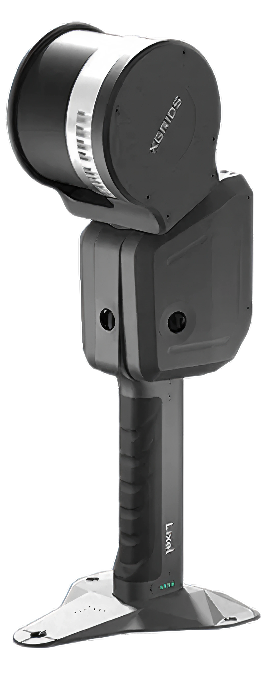
Long-range handheld SLAM LiDAR for corridors, infrastructure, and large sites — real-time colourised point clouds from handheld, backpack, vehicle, or drone.
The L2 Pro sits above the Lixel K2 in the XGRIDS range. It is available to rent in Singapore for enterprise and project work.
640,000 pts/s · up to 300 m range · 2×48 MP panoramic · handheld / vehicle / UAV
Key specs
640k
Points per second · 32-ch
300 m
Max range · extended variant
≤1 cm
Relative accuracy
1M
Points per m² · 1 mm spacing
Why it matters
Why the Lixel L2 Pro matters.
Scale beyond the handheld walk
With 120–300 m range and up to 640,000 pts/s, the L2 Pro captures corridors, building exteriors, and infrastructure that would take a shorter-range scanner many passes — or simply be out of reach.
Real-time, post-processed quality
Multi-SLAM AI fuses LiDAR, dual 48 MP vision, and a 500 Hz IMU on-device, producing colourised point clouds in real time that approach post-processed quality — review deliverables before leaving site.
One device, four platforms
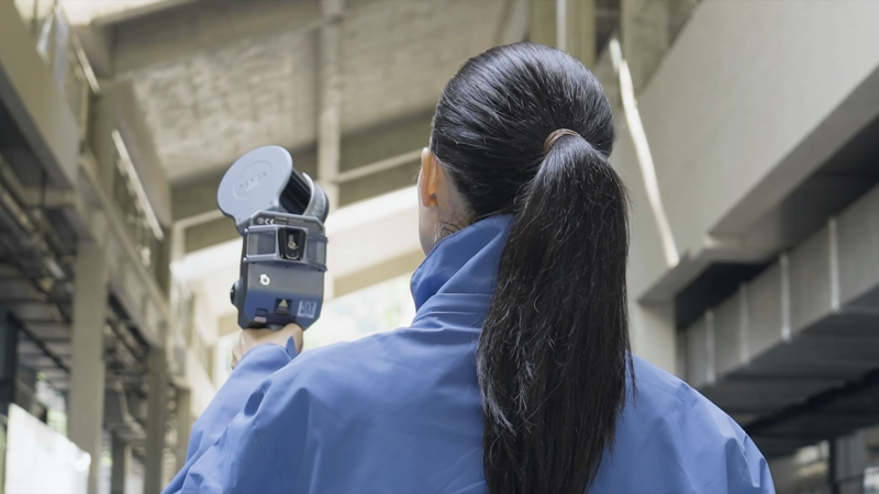
Handheld, backpack, vehicle mount, and UAV mount from a single unit — the same sensor covers a stairwell walk in the morning and a road corridor or aerial sweep in the afternoon.
Variants
Three configurations, one platform.
16-Channel · 120 m
Interiors & medium sites
320,000 pts/s. Covers building documentation, utilities, confined spaces, and sites under 120 m at the entry point of the range.
32-Channel · 120 m
Double the density
640,000 pts/s at the same range — denser clouds, smoother surfaces, and fewer artefacts for detail-critical deliverables.
32-Channel · 300 m
Extended range
640,000 pts/s out to 300 m for large exteriors, corridors, and infrastructure — same relative accuracy envelope as the shorter-range variants.
Capabilities
Built for production mapping.
Multi-SLAM + 500 Hz IMU
Continuous positioning in satellite-limited environments — indoors, subways, tunnels — with ~3 cm absolute accuracy held within 100 m of the last RTK fix.
Photo-quality colourisation
Dual 48 MP panoramic cameras (190°×190°) and the LixelUpSample algorithm deliver true-colour point clouds in real time.
Detachable RTK
RTK accuracy of H 0.8 cm + 1 ppm / V 1.5 cm + 1 ppm for georeferenced survey workflows, with breakpoint rescan and control point collection.
1 TB onboard SSD
Full-day capture programmes without offloading, in an IP54 aluminium body rated to −20 °C.
Deployment
Four ways to put it to work.
Handheld
Walk-through capture of interiors, stairwells, and sites — ~1.7 kg excluding battery.
Backpack
Hands-free module for long capture routes and uneven terrain.
Vehicle mount
Suction mount with monitoring — road and corridor mapping at up to 40 km/h with live point cloud preview.
UAV mount
Vibration-damped drone mounting (e.g. DJI Matrice 300/350 RTK) for aerial coverage of large areas.
Use cases
Workflows the L2 Pro is built for.
Road & rail corridor mapping
Vehicle-mounted capture of linear infrastructure at driving speed.
Topographic survey
Dense, georeferenced terrain capture for engineering measurement.
Infrastructure inspection
Bridges, plants, and utilities documented at long range.
Stable mapping in satellite-denied subways, tunnels, and basements.
Large-site construction
Progress and as-built records across sites too large for short-range walks.
Forestry & terrain
Vegetation and landscape capture in remote or difficult conditions.
Film, games & large 3DGS scenes
Building-scale Gaussian Splatting environments via LCC, with Unity/Unreal SDKs.
Specifications
Lixel L2 Pro specifications.
Specifications vary by variant (16-channel vs 32-channel, 120 m vs 300 m) and depend on configuration, software workflow, site conditions, and processing. Confirm project requirements before any arrangement.
Corridors, large sites, aerial coverage · 120–300 m
Buildings, interiors, mixed sites
Point rate
320,000–640,000 pts/s
200,000 pts/s
Relative accuracy
≤1 cm
1 cm
Operation
Handheld, backpack, vehicle, or UAV mount
Handheld walk-through
Weight
~1.7 kg excl. battery
~1.2 kg
Typical users
Enterprise survey and mapping programmes
Project teams, studios, evaluators
Outputs
LAS · LAZ · E57 · PLY · 3DGS
Point cloud · mesh · 3DGS
Rental status
Available to rent
Featured rental focus
For most short-term Singapore projects, the K2 covers the requirement. The L2 Pro is relevant when range, point density, or platform mounting is the deciding factor.
Enquiries
Enterprise enquiries, reviewed separately.
Long-range and enterprise LiDAR projects involve different logistics, risk, and approvals than a weekly K2 rental. If your project needs L2 Pro-class equipment, describe the site, coverage, and platform — each enquiry is reviewed on its own terms.
Site scale and required coverage
Variant requirement — 16-ch / 32-ch, 120 m / 300 m
The L2 Pro is available to rent in Singapore. Describe the site scale, platform (handheld, vehicle, or UAV), required outputs, and dates.
Which L2 Pro variant should I choose?
The 16-channel 120 m variant covers most interiors and medium-range sites. The 32-channel 120 m variant doubles point density to 640,000 pts/s for denser deliverables. The 32-channel 300 m variant extends range for corridors, building exteriors, and infrastructure.
Can the L2 Pro be mounted on a vehicle or drone?
Yes. Dedicated mounts support vehicle capture at speeds up to 40 km/h with live point cloud preview, and UAV deployment on platforms such as the DJI Matrice 300/350 RTK.
What outputs does the L2 Pro produce?
Point clouds in LAS, LAZ, E57, and PLY via LixelStudio, plus photorealistic 3D Gaussian Splatting models via Lixel CyberColor (LCC) — including a GS-to-BIM Revit plugin workflow.
How does the L2 Pro compare to the Lixel K2?
The K2 is a ~1.2 kg walk-through scanner for buildings, interiors, and mixed sites. The L2 Pro is the larger platform — higher point rates, far longer range, denser clouds, and vehicle/UAV mounting. For most short-term Singapore projects the K2 covers the requirement.
Does the L2 Pro work indoors or underground?
Yes. Multi-SLAM fusion of LiDAR, vision, and a 500 Hz IMU maintains continuous positioning in satellite-limited environments such as indoor spaces, subways, and tunnels — holding around 3 cm absolute accuracy within 100 m of the last RTK fix.
Not sure which device fits the scale?
Start with the comparison, or send the project details and we'll recommend whether K2 rental or an enterprise enquiry is the right path.