 360 capture · Street View ready
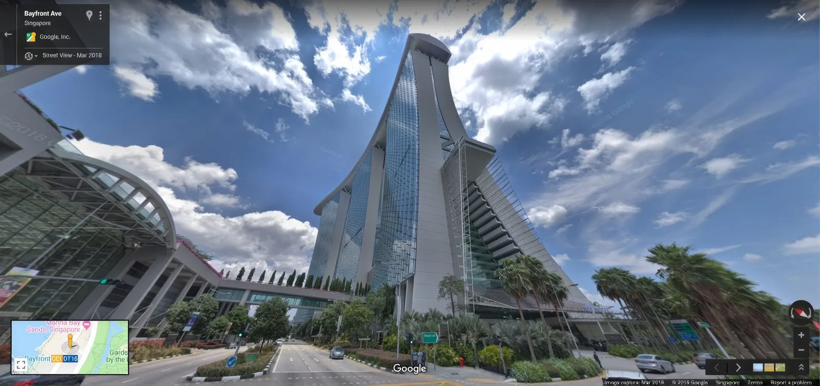 Street View · published
360 capture of interiors, campuses and access routes, prepared to Google’s publishing specification and pushed live on Maps, so people can walk the space before they arrive.
360 capture · Street View readyStreet View · publishedA connected run of 360 panoramas covering the spaces you nominate, positioned and linked so a visitor can move through the building the way they would on the street. You get the published imagery on Google Maps plus the source equirectangular panoramas at full resolution, which stay useful for your own site, listings and virtual tours.
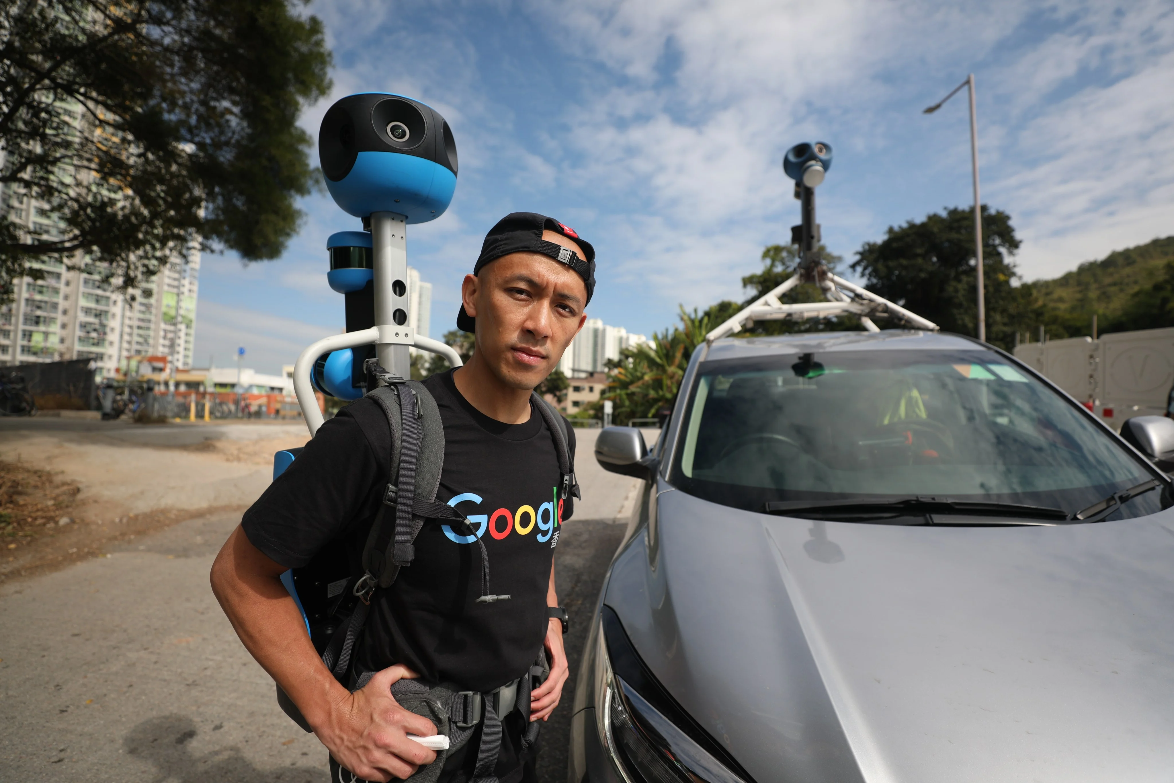
Where a route runs outdoors, a campus path, a carpark approach, a jetty, trolley and backpack capture continues without breaking the sequence, so the walk into the building is one journey rather than two datasets.
Imagery must meet Google’s specification before it is accepted: resolution, overlap, positional accuracy, and faces and licence plates blurred. We handle that preparation, submit the imagery, and confirm once it is live. Publishing is under your business profile, so the imagery stays attached to your listing rather than ours.
Anything you would rather not show is agreed before capture and excluded: back of house, server rooms, occupied desks, plant. Where a space needs measurable geometry as well as imagery, 3D laser scanning runs on the same visit.
Street View imagery is a path, not a set of rooms, so the useful planning question is: what journey should a visitor be able to take? A typical route starts at the street or carpark, moves through the entrance, covers the public circulation, branches into the spaces you want seen, and ends where a visitor would stop. Panorama spacing is set to keep movement smooth without inflating the capture; junctions and lifts get extra positions because that is where people get lost.
We also plan for what should not connect. A route that quietly leads into staff areas is a privacy problem, so exclusions are set as breaks in the path rather than as edits after the fact.
Google’s requirements are specific and unforgiving: sufficient resolution and overlap, correct positional and orientation data, connected imagery rather than isolated spheres, and privacy blurring applied. Imagery that fails is rejected or simply never appears, which is why DIY 360 uploads often go nowhere.
Our process assumes the spec: capture positions logged, sequences verified before leaving site, panoramas processed and quality-checked, blurring applied, then submission and confirmation. If Google rejects anything, remediation is part of the job rather than an extra.
Capture is usually a single visit. Processing and Google’s own review add time after that, so treat publication as weeks rather than days. We confirm when the imagery goes live and send the links. Where you need something on your own site sooner, the source panoramas are available immediately after processing, so a Maps delay does not block your marketing.
They answer different questions. Street View is about discovery: the imagery lives where people are already searching, attached to your listing, with no click required. A Matterport tour is about depth: structured navigation, tags carrying documents and asset data, floor plan views, measurement for space planning, and control over who sees it.
Most businesses that care about walk-in traffic want Street View; most that care about facilities, leasing or documentation want a tour; a fair number want both, and one capture visit can serve both if we plan it that way. For photoreal presentation of a hero space, 3DGS is the third option.
Priced by floor area, route length and site count. What else moves it: the number of separate buildings or units, indoor-to-outdoor transitions, out-of-hours capture where the space must be clear of people, and how many exclusions fragment the route. Multi-outlet programmes price lower per site once the capture standard is set.
Send the address and what you want covered to get a quote.
Brands with several outlets get more from Street View than single sites do, because consistency is what makes the imagery read as one company rather than a dozen separate uploads. We set a capture standard on the first two or three sites: route pattern, panorama spacing, presentation checklist, exclusion rules, what “ready to capture” means for staff, then repeat it across the estate.
That standard is worth writing down. It covers the obvious things (lighting on, screens on brand, promotional material current, no staff in frame) and the less obvious ones (which door counts as the entrance, whether the route includes the queue line, how far into the carpark the approach starts). Once agreed, each subsequent site is a short visit with a predictable result and a predictable price.
Scheduling is usually the constraint rather than capture. Outlets trade at different hours, some need pre-opening slots, and a national rollout tends to be sequenced by region. We plan the programme against your operating hours and report progress by site, so marketing and operations can see which locations are live.
Where a brand also wants depth per site, tagged tours for facilities or leasing, one visit can serve both; tell us at planning stage and the route is captured with both outputs in mind.
Street View imagery is permanent until it is replaced, so an hour of preparation is the highest-return part of the whole exercise. What matters, in rough order of impact.
Lighting as normal, and all of it on. Half-lit spaces read as closed. Screens and signage current: expired promotions date the imagery instantly. Clutter cleared from circulation and counters. Staff and customers out of the frames being captured, which is why pre-opening or post-closing slots are the usual choice. Doors open along the route so the sequence connects.
Decide exclusions before the day: back of house, offices, server and plant rooms, anything with visible personal data, and any area a client or tenant would object to. Exclusions are handled as breaks in the route, so they need to be known in advance rather than edited later.
Two administrative items to settle in parallel. Your Google Business Profile must exist and be verified, because publishing attaches to it: an unverified profile is the most common cause of a stalled publication. And if the building is managed rather than owned, get the manager’s agreement to capture the common areas your route passes through.
Send a floor plan or a rough sketch of the route with your enquiry and we will mark the panorama positions and exclusions on it before anyone mobilises, so what gets published is what you expected.
Once imagery is live it behaves like part of your listing rather than like a marketing campaign: it sits in Search and Maps, it is what people see when they check where you are, and it works without further spend. Two things are worth doing afterwards.
Use the panoramas elsewhere. The full-resolution equirectangulars are yours, so they can carry a 360 viewer on your own site, feed a listing page, or sit in a deck. Most clients under-use this and pay for separate photography that the same visit already produced.
Plan the refresh. Imagery ages with the fit-out. A refit, a rebrand or a layout change is the point to recapture, because outdated interior imagery is worse than none: a visitor who arrives expecting the old room notices. Where a brand has several outlets, refreshing them as each is refitted keeps the estate consistent without a single large programme.
Tell us at planning stage if a refit is on the horizon; there is rarely value in capturing a space weeks before it changes.
The visitor journey mapped; private areas agreed as breaks in the path before capture.
Connected panoramas indoors and out: trolley and backpack capture keeps the sequence unbroken.
Panoramas processed, sequences verified, faces and plates blurred to Google's specification.
Imagery published against your Google Business Profile; rejections remediated as part of the job.
Live links confirmed, and full-resolution source panoramas delivered for your own use.
| Deliverable | Format | Notes |
|---|---|---|
| Published Street View imagery | Google Maps | Attached to your Business Profile, discoverable in Search and Maps |
| Source panoramas | Equirectangular JPEG, full resolution | Yours to reuse on your site, listings and decks |
| Connected sequence data | Positions and links | The path a visitor walks, indoors and outdoors |
| Privacy pass | Applied before submission | Faces and licence plates blurred; agreed exclusions omitted |
| Hosted tour | Matterport tour | Where depth and tagging matter: via virtual tours |
| Measured point cloud | E57 · LAS / LAZ | Where geometry is needed too: via laser scanning on the same visit |
Publication timing depends on Google’s review. Source panoramas are available as soon as processing is done, so your own channels are not held up.
Both. The imagery is prepared to Google's specification and published against your business profile, and you keep the full-resolution source panoramas for your own use.
Yes. Blurring is applied before submission, and any area you ask us to leave out is agreed before capture rather than edited afterwards.
Capture is usually a single visit. Processing and Google's own review add time after that, so treat publication as weeks rather than days.
Yes. Trolley and backpack capture continues across carparks, campus paths and approaches, so the journey into the building is one unbroken sequence.
Yes, and it is planned as a break in the route before capture: cleaner and safer than editing imagery afterwards.
Google requires sufficient resolution and overlap, correct position and orientation data, connected sequences and privacy blurring. Imagery that misses those requirements is rejected or never surfaces.
Yes: publishing attaches the imagery to your profile. If the profile needs setting up or verifying, do that before capture so publication is not held up.
Street View for discovery, since it lives where people already search. A tour for depth: navigation, tags, documents and space planning. One visit can serve both if planned that way.
Imagery published against your profile can be replaced with a newer capture, which is how a refit is handled. Removal requests go through Google; we prepare and submit the replacement.
It puts a walkable view of your premises on the listing people already find, which is a conversion and confidence asset. We do not make ranking promises: Google does not publish that relationship and neither will we.
Yes. Each level is captured as a connected sequence and linked at the lift lobbies and stairs, so a visitor can move between floors the way they would in the building.
It is handled before capture: the route is planned with exclusions as breaks in the path, and any area under dispute is left out. Retrospective edits are slower and messier than planning around it.