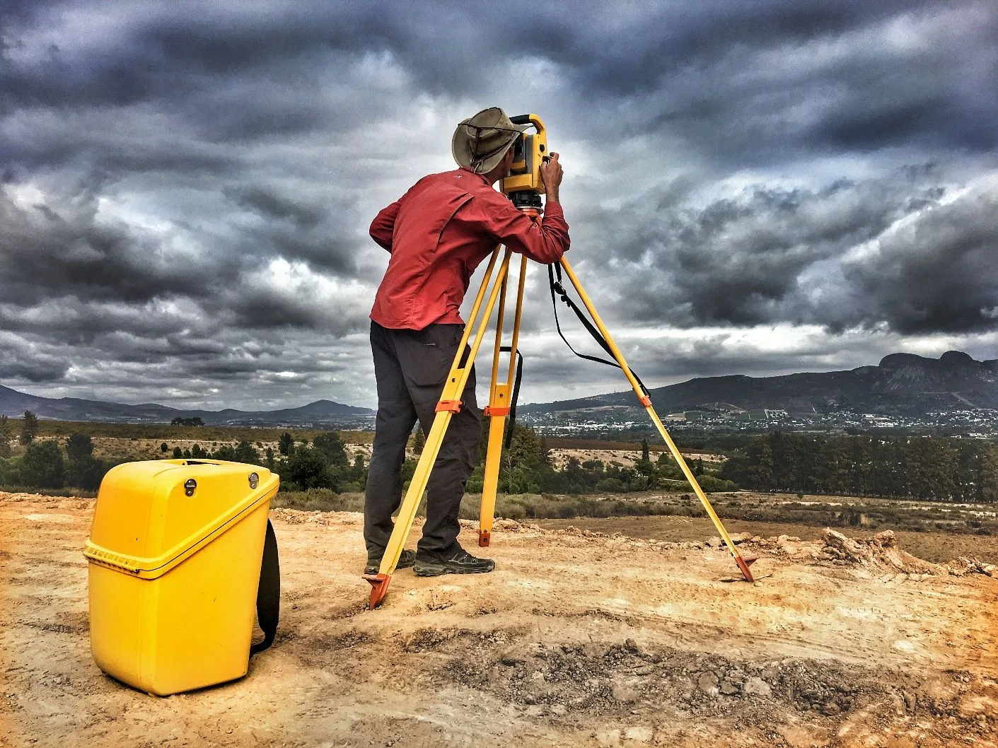
 Topographic capture · site extent
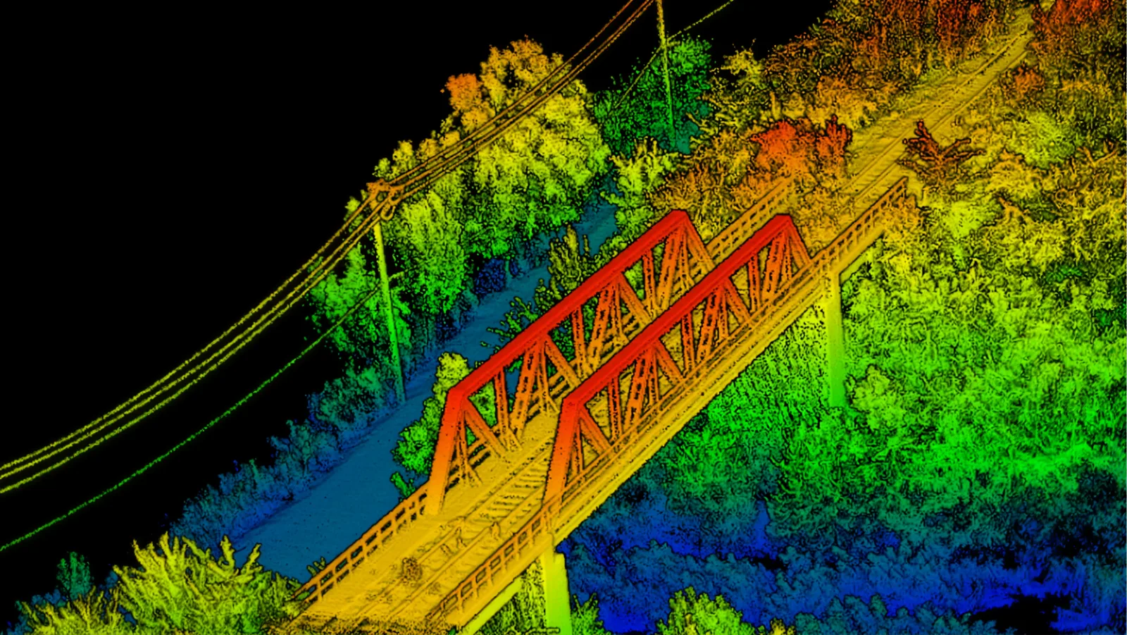 Bridge · LiDAR point cloud
Terrain, levels, volumes and site documentation, captured by ground and aerial LiDAR and delivered as CAD drawings, terrain models and point clouds. Cadastral and boundary work is the statutory preserve of a Registered Surveyor: we say so plainly, and refer it.
Topographic capture · site extentBridge · LiDAR point cloudTopographic plans in DWG and PDF to your layer conventions, a digital terrain model, the underlying point cloud, and volume computations where earthworks or stockpiles are the question. Ground LiDAR and drone survey combine on larger or vegetated sites. Where a building sits on the site, the same mobilisation can capture it for as-built documentation.
Plans are delivered with the survey date, the datum and coordinate system used, the capture method with its accuracy conditions, and a note of areas that were inaccessible or obscured. A topographic plan that does not declare its datum is a plan somebody will have to survey again.
Cadastral and boundary survey in Singapore, legal boundaries, strata subdivision plans, title survey, is the statutory preserve of a Registered Surveyor. Volumet does not hold that registration and does not imply cadastral authority. What we provide is topographic and measured survey, volumes and site documentation; where your project needs cadastral work, we refer you to a Registered Surveyor and can supply the measured base data they work from.
In practice the split is clean. Where the boundary line legally sits, and any plan that will be lodged as a cadastral or strata document, is Registered Surveyor work. Everything about the physical site is measured survey, and that is what we do: levels, contours, features, structures, vegetation, hard landscape, service covers, volumes and change over time. If your brief mixes the two, say so early and we will tell you which parts to route where before anyone quotes.
Method follows the site, not the price list. Open ground with clear sky goes fastest from the air. Sites under canopy or between buildings need ground capture, because a photogrammetric flight cannot see the surface it is meant to model. Long, thin sites, a drain reserve, an access road, a boundary strip, suit long-range handheld LiDAR walked end to end, which is why the Lixel L2 Pro’s 120 m standard range earns its place. Tight, cluttered or high-accuracy areas take tripod stations.
Most jobs use two methods and register them together against the same control, so the deliverable is one surface rather than several that disagree at the seams. Where GNSS is weak, dense urban blocks, under structures, we plan the survey around that rather than reporting a coordinate we cannot defend.
A volume is a difference between two surfaces, so its credibility depends entirely on how both were captured. We state the base surface used, original ground, a previous survey, or a design surface, the method and date of each, the point density behind them, and the computation method. Repeat monitoring uses the same control and the same surface definition every visit, because a stockpile that appears to shrink because the method changed is worse than no measurement at all.
For stockpiles we note the practical limits too: material toe lines under vegetation, moisture and bulking, and the assumption made where the base under a pile cannot be seen. Those caveats are what make the number usable in a payment application.
Tell us at brief stage which datum and coordinate system the project runs on, and whether existing survey data must be matched. Levels tied to the wrong datum are the single most expensive avoidable error in site survey: drainage falls designed on a mismatched benchmark do not become visible until they are built. Where the project has no existing control, we establish and record it, and hand over the control record with the deliverables so the next survey can tie in without repeating this one.
Dense vegetation reduces what any method can see and pushes the job towards LiDAR. Standing water hides the surface beneath it. Active plant, stockpiling and haulage mean parts of the site are moving while being measured, so we agree either a snapshot time or a phased capture. Fresh earthworks change daily, which is why monitoring cadence should be agreed with the programme rather than picked arbitrarily. And access, the gate, the induction, the permit, the escort, is what usually determines the date.
Cost is driven by site area and shape, vegetation and access, accuracy specification and control requirements, whether the deliverable is a plan, a surface, volumes or all three, and the visit cadence. Delivery for a modest site is typically within a week of capture; volumes on a monitoring cycle turn around faster because the setup is established.
Send the site extent and what the survey must answer to get a quote. If cadastral work is part of the picture, we will point you to a Registered Surveyor for that piece.
Four things make a land survey quote accurate rather than approximate. The extent: a boundary on a plan, a KML, or a clearly described area: “the whole site” means different things to different people. The question: whether you need a plan for design, a surface for earthworks, volumes for payment, or a record before works start. The datum and coordinate system, plus any existing survey the new work must match. The cadence: one visit, or repeat monitoring, and on what interval.
Helpful extras: existing survey files however old, the design surface if comparison is the point, known access and induction requirements, and a note of vegetation or standing water. Each of those changes method selection, and method selection is most of the price.
If cadastral work is in the mix, a boundary line to be confirmed, a strata plan to be lodged, flag it in the brief. We will identify which parts are Registered Surveyor work, route those, and quote the measured survey around them so the two pieces do not overlap or leave a gap. Doing that split at brief stage is considerably cheaper than discovering it during a submission.
Most site survey questions are actually comparison questions: how much material moved, whether the platform is at design level, whether a neighbouring structure has been affected, what the site looked like before works started. Comparisons are only as good as their consistency, so the discipline matters more than the instrument.
Our rule is that repeat surveys reuse everything: the same control, the same datum, the same capture method, the same processing settings and the same surface definition. When one of those has to change, a control point destroyed by works, for instance, it is recorded in the deliverable, because an unexplained change in method looks exactly like a change on the ground.
Two comparison jobs come up constantly in Singapore. Pre-works condition records: a measured record of the site and adjacent structures before piling, excavation or demolition, which is the document that resolves later claims about who caused what. Design-surface verification: comparing the built surface against the design model to confirm levels and falls before the next trade arrives, when correction is still cheap.
Both are inexpensive relative to what they protect against, and both depend on being done before the work rather than after the dispute. If either is on your programme, put the first survey in early: the baseline is the survey that cannot be recreated later.
Site extent, datum, deliverables and accuracy target agreed; cadastral elements routed to a Registered Surveyor.
Existing control verified, or new control established and recorded for reuse.
Aerial, long-range handheld or tripod LiDAR: usually a combination, registered to the same control.
Terrain model built, features drawn, volumes computed against a stated base surface.
DWG, PDF, DTM and point cloud with datum, method, accuracy and exclusions declared.
| Deliverable | Format | Typical use |
|---|---|---|
| Topographic plan | DWG · PDF | Design, planning submissions via your consultant, records |
| Contours and spot levels | DWG | Drainage, earthworks and platform design |
| Digital terrain model | LandXML · DWG · GeoTIFF | Surface for design, comparison and volumes |
| Volume report | PDF · XLSX | Cut-and-fill and stockpile quantities with stated base surface |
| Point cloud | E57 · LAS / LAZ | The measured source, re-checkable and reusable |
| Orthomosaic | GeoTIFF | Plan-view imagery of the site: via drone survey |
| Control record | Benchmarks and coordinates so the next survey ties in |
Cadastral and strata plans are not in this list, that work belongs to a Registered Surveyor, and we refer it.
A measured record of a site’s terrain and features, levels, contours, structures, services covers, hard landscape, delivered as CAD drawings and a terrain model for design and planning.
No. That work is the statutory preserve of a Registered Surveyor. We provide topographic and measured survey and refer cadastral work, and can supply the measured base data the Registered Surveyor works from.
Topographic plans in DWG and PDF, DTMs in LandXML or DWG, point clouds in E57 or LAS/LAZ, and volume computations with the base surface stated.
As the difference between two stated surfaces. Reliability depends on how both were captured, so we declare the base surface, method, date and density behind each, and keep them identical across monitoring visits.
Whichever the project runs on: tell us at brief stage, along with any existing survey to be matched. Where there is no control, we establish and hand over a control record.
Yes, with LiDAR. Photogrammetry cannot see ground under canopy; airborne and ground LiDAR can penetrate gaps in vegetation well enough to build a usable terrain model.
For a modest site, typically within a week of capture. Monitoring cycles turn around faster because control and setup are already established.
Not by laser. We record visible evidence, covers, chambers, valve boxes, marker posts, and their measured positions. Buried service detection is a separate specialism using electromagnetic or GPR methods, and we will say so rather than imply coverage.
Yes. Active plant, haulage and stockpiling mean parts of the site move during capture, so we agree either a snapshot time or a phased approach, and note it in the deliverable so comparisons stay honest.
Setting out is construction work carried out to a designer’s drawings, and boundary pegging is Registered Surveyor work. We measure and record; where either of those is needed we point you to the right party.
Yes, if you send it. We tie into the existing control and datum where they can be recovered on site, and report clearly where they cannot: an unreconciled datum is the most expensive error in site survey.