This is a project we did not run, written up because the whole pipeline and its timings are on record. The case study was documented by Philipp Posch and published by XGRIDS, and it is the same workflow we run on Singapore sites with the same equipment. Images throughout are courtesy of XGRIDS and Philipp Posch. The walkthrough clips below are from the project itself, and are reproduced here with the original case study as the source.
| Detail | Value |
|---|---|
| Location | Salzburg, Austria |
| Scale | 500 sqm |
| Timeline | 1 hour scanning, 5 hours post-processing, 2 months modelling |
| Deliverables | Point cloud, LOD 400 BIM model, 3DGS scene |
| Solution | XGRIDS Lixel L2 Pro, LixelStudio, LCC Studio, Revit |
| Source | Philipp Posch |
The challenge
During renovation and expansion work on an existing building, fast Scan-to-BIM delivery is what keeps designers, contractors and the owner coordinating against the same record. In a complex industrial environment, traditional survey methods miss essential detail. Tripod-based laser scanners offer high accuracy, but they need days or weeks on site, which disrupts production, drives up labour cost and leaves a substantial registration job at the end.
Project overview: a more efficient way to deliver Scan-to-BIM
The client's objective was to capture accurate spatial data for BIM modelling without interrupting ongoing production, then deliver a high-precision model of the factory. Four things were asked for:
- Indoor and outdoor 3D scanning inside a single workflow
- Optimised, cropped point cloud data in BIM-ready formats
- A Revit LOD 400 BIM model, using the point cloud as reference
- A 3D Gaussian Splatting (3DGS) model as a high-fidelity digital archive
Workflow breakdown
1. Field capture
Using the Lixel L2 Pro handheld scanner, the client captured indoor and outdoor factory spaces in one session. Compared with a tripod system, handheld scanning allows:
- Free movement through complex environments
- Capture at varying heights
- Real-time point cloud preview on the mobile app, for completeness checks while still on site
The approach cut on-site time and manpower while still producing reliable BIM-ready data.
2. Data processing
The walks were imported into LixelStudio for post-processing:
- SLAM-based automatic alignment, with no manual registration
- Point cloud cropping down to what the BIM scope required
- Direct RCP export for Revit, with no third-party conversion tool
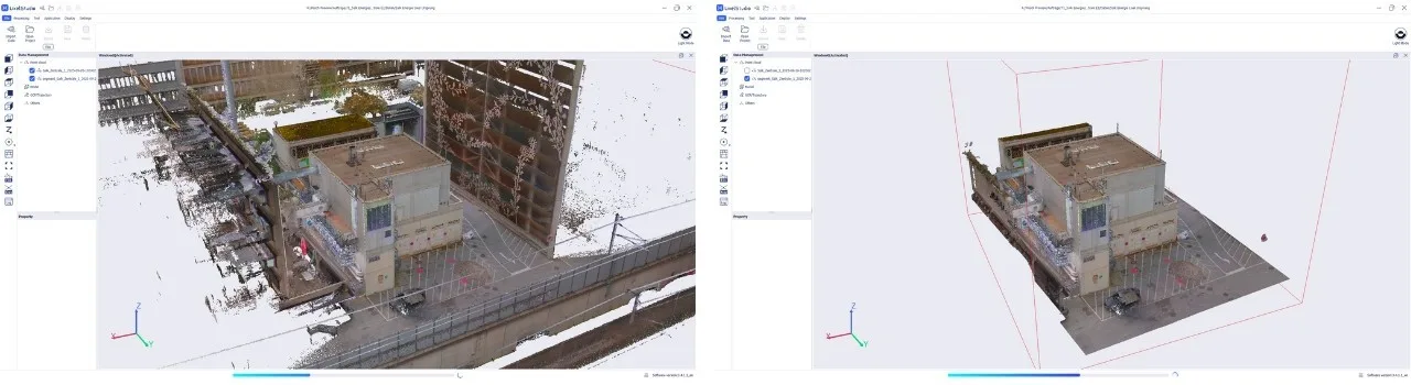
The entire pipeline stays inside the native software, which is what shortens the path from scan to BIM reference. A conventional workflow usually passes the cloud through a separate registration package and then a conversion tool before Revit will accept it, and each hop is licence cost, learning curve and another chance to lose accuracy.
3. BIM modelling
The RCP point clouds were imported into Revit as modelling references, and structural, spatial and equipment elements were built up progressively against them. The project delivered an LOD 400 model, which validates the point cloud as a reliable reference for professional Scan-to-BIM work rather than just a visualisation.
Two months of drafting produced that model, detailed enough for fabrication and assembly rather than coordination alone. The ratio is worth sitting with: one hour of capture, five hours of processing, two months of modelling. Scanning is never the long pole. What the model is for is.
4. Alignment verification
The final deliverables showed high alignment between the BIM model and the point cloud, both in spatial positioning and in component scale. Point clouds may not be visually perfect, and they do not need to be. Their engineering reliability shows up in the finished model. A cloud with some noise in it that puts every column where the column really is beats a clean-looking dataset that quietly drifts.
5. 3DGS as an additional deliverable
Alongside the point cloud, a 3D Gaussian Splatting model was generated in LCC Studio from the same capture. It provides a distinct kind of value:
- High-fidelity visual documentation of existing conditions
- Long-term preservation of concealed or hard-to-access elements
- Accessible viewing for stakeholders who do not open BIM software
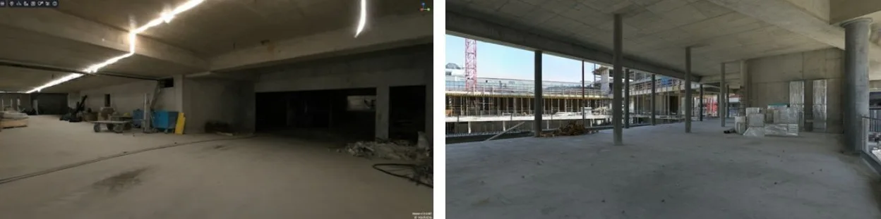
3DGS adds a complementary data dimension. It does not replace the point cloud or the model.
Scalable results: from a single project to repeatable use
The client has since applied this workflow across multiple AEC projects. One representative construction site showed the following gains.
| Metric | Value |
|---|---|
| Scan area | ~7,800 sqm |
| On-site scanning | 4 hours |
| Post-processing | 16 hours (automated) |
| Traditional approach cost | €28,000 (estimated) |
| XGRIDS solution cost | ~€8,000 |
| Cost saving | >70% |
Those are European figures from the published case study, not a Volumet quote, so read them as a ratio rather than a price. The project also confirmed stable performance in low-light construction conditions, which is where camera-dependent methods tend to fall over.
Key takeaways
Cost efficiency. Significant reductions in hardware investment, on-site labour, software dependency and total cost of ownership, measured against a tripod-based workflow.
Streamlined workflow. A direct path from scan to BIM reference, with no manual registration and no third-party point cloud conversion software. Scan-to-BIM projects stop hinging on specialist availability and complicated coordination between tools.
Extended deliverables. A single scanning effort supports BIM modelling, digital archiving, stakeholder communication and site management, which is what amplifies the return on one site visit.
What this looks like on a Singapore site
We run this pipeline here, with our own team and equipment. A typical commercial floor plate is a morning of capture, processing and registration land the same week, and the modelling schedule then depends on the LOD you need and how much building services detail is in scope.
Three things are worth agreeing before anyone arrives on site:
- Tolerance. What the model has to be accurate to, which decides whether the capture plan needs control points or a tripod scanner in specific areas.
- Level of development. LOD 200 and LOD 400 come off the same point cloud and differ by weeks of drafting.
- Formats. RCP for Revit, LAS as the archival master, E57 when a consultant needs a vendor-neutral copy, IFC where the model has to cross platforms.
If you have a renovation, an extension or an asset documentation job coming up, tell us about the building and we will come back with a capture plan and a schedule. The related services are Scan-to-BIM, as-built documentation and 3D laser scanning.