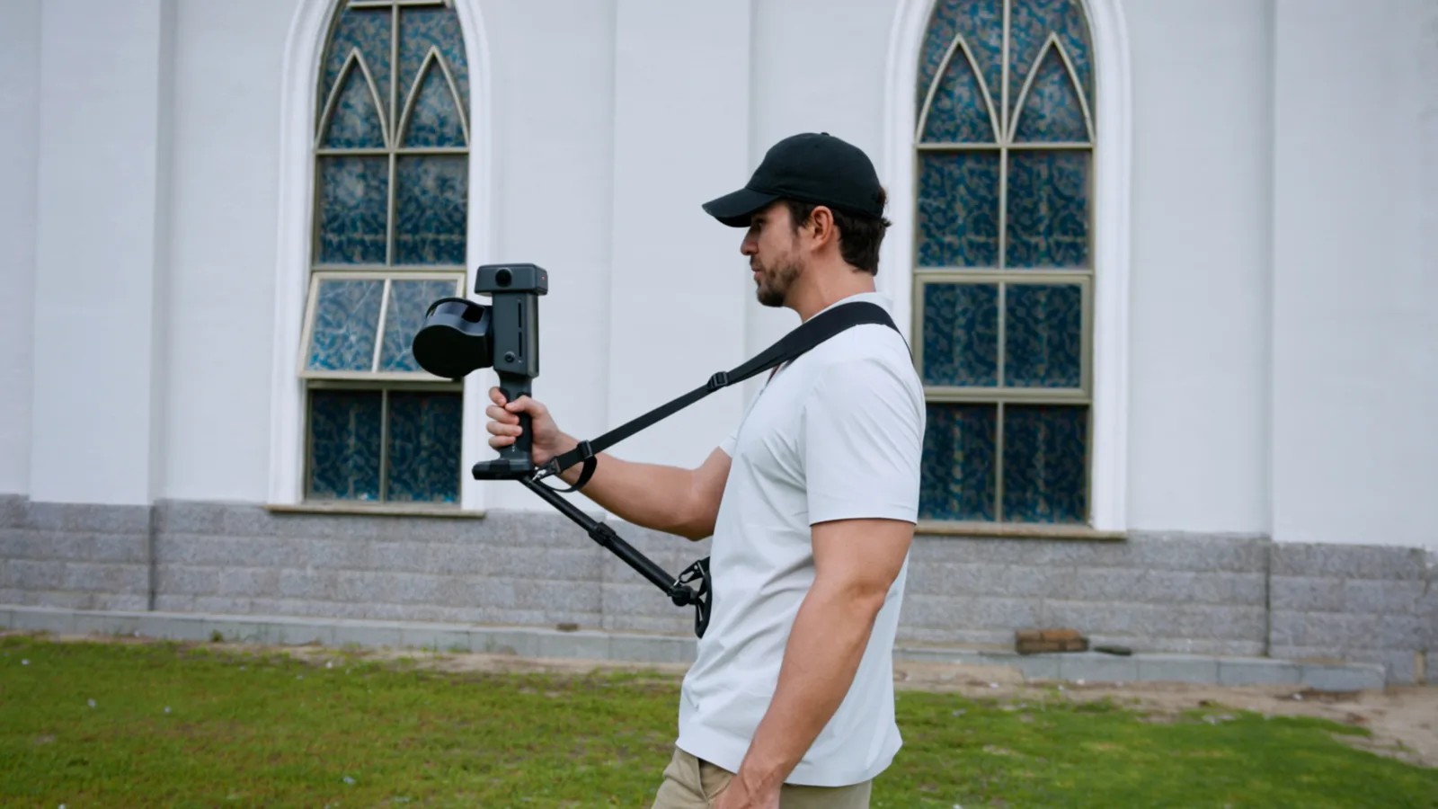
XGRIDS announced the Lixel L3 on 15 September 2026. It is a handheld SLAM scanner specified at 5 mm post-processed relative accuracy, scanning from 0.7 m to 120 m at up to 640,000 points per second, with the RTK receiver built into the body instead of clipped on top. One walk produces a point cloud, a mesh and a 3D Gaussian Splatting scene. XGRIDS has not published a price or a Singapore date.
What the Lixel L3 is
You walk the site at normal pace and the device builds a colourised point cloud as you go, fusing laser ranging, camera imagery, an inertial measurement unit and satellite positioning into one continuous trajectory. No tripod, no station setups, no targets. Same principle as the Lixel K2, built for tighter tolerances.
There are two versions. They differ only in the LiDAR head: 16 channels at 320,000 points per second, or 32 channels at 640,000. Range, cameras and accuracy are identical across both.
Accuracy, and the conditions attached to it
XGRIDS publishes nine accuracy figures, each with its own test conditions. Those conditions matter as much as the numbers.
| Measure | Specification | Stated test condition |
|---|---|---|
| Post-processed relative accuracy (1σ) | 5 mm | Dedicated 500 m² test environment |
| Post-processed point cloud thickness | ≤5 mm | Within 10 m of the walking path |
| Absolute accuracy, horizontal (RMSE) | 2 cm | Open sky, no multipath, good satellite geometry |
| Absolute accuracy, vertical (RMSE) | 2 cm | Open sky, no multipath, good satellite geometry |
| Repeatability | 2 cm | Open sky, no multipath, good satellite geometry |
| Real-time relative accuracy | 1 cm | Laboratory conditions |
| Real-time absolute accuracy (RMSE) | 2.5 cm | Open sky; WGS 84 and CGCS2000 only |
| Levelling, with RTK fusion | 0.005° | Open sky, no multipath |
| Levelling, without RTK fusion | 0.02° | Laboratory, 2,000 m² scene |
The 5 mm figure comes from a purpose-built 500 m² test room: small, controlled, full of features for the SLAM to lock onto. Your sites are none of those things. Long blank corridors, glass, moving people and closed loops all degrade it, so scope your tolerances against something looser than 5 mm.
Every absolute-accuracy number assumes open sky. Put the device between high-rises in the CBD and satellite geometry becomes the limit, not the scanner. None of this is unique to XGRIDS. Every SLAM manufacturer quotes its best room.
LiDAR module
| Laser class | Class 1, 905 nm (eye-safe) |
| Range | 0.7 – 120 m |
| Field of view | 360° × 270° |
| Point rate | 320,000 pts/s (16-channel) · 640,000 pts/s (32-channel) |
| Channels | 16 or 32 |
The 360° × 270° field of view is what lets you capture a plant room or a car park in one pass. Ceilings, soffits and overhead services are recorded as you walk, without tilting the device to catch them.
Watch the 0.7 m minimum indoors. Anything closer than that is not recorded at all, which is easy to forget in a tight riser or against a wall you are squeezing past.
Imaging
| Forward camera | 1 × , field of view 100° × 75° |
| Panoramic cameras | 2 × , field of view 200° × 200° each |
| Resolution | 4096 × 3072 per camera |
| CMOS sensor | 1/1.3" |
| Shutter | Rolling |
| HDR | DCG HDR |
Ignore the megapixel count and look at the sensor. At 1/1.3" the L3 gathers far more light than a smaller chip, which is what decides whether a basement, riser or plant room comes back usable. DCG HDR handles the other common problem: a bright window and a dark interior in the same frame.
Image quality carries straight through to 3D Gaussian Splatting, where the photographs are the deliverable rather than a texture stretched over geometry.
Positioning and GNSS
The GNSS receiver sits inside the housing and tracks BeiDou, GPS, GLONASS, Galileo, QZSS, IRNSS and SBAS. XGRIDS quotes 0.8 cm + 1 ppm horizontal and 1.5 cm + 1 ppm vertical, through a 360° right-hand circular polarised antenna at 4.0 dBi peak gain.
QZSS is the one to notice here. It is the Japanese augmentation constellation and it covers East and Southeast Asia, so it adds usable satellites over Singapore in exactly the obstructed streets where a scanner needs them.
Hardware, power and environment
| Dimensions | 206 × 107 × 329 mm |
| Weight | Approx. 2.5 kg including battery |
| Housing | Aluminium alloy |
| Display | 4.3" TFT, up to 1,000 nits, 480 × 800 |
| Internal storage | 1 TB UFS |
| Data interface | USB 3.1 Gen2 |
| Wireless | Wi-Fi 802.11 a/b/g/n/ac/ax, Bluetooth 2.1 to 5.2 |
| Battery | 14.4 V, 3350 mAh |
| Operating time | 100 minutes |
| Power consumption | Under 30 W |
| Operating temperature | -20°C to 50°C |
| Ingress protection | IP54 |
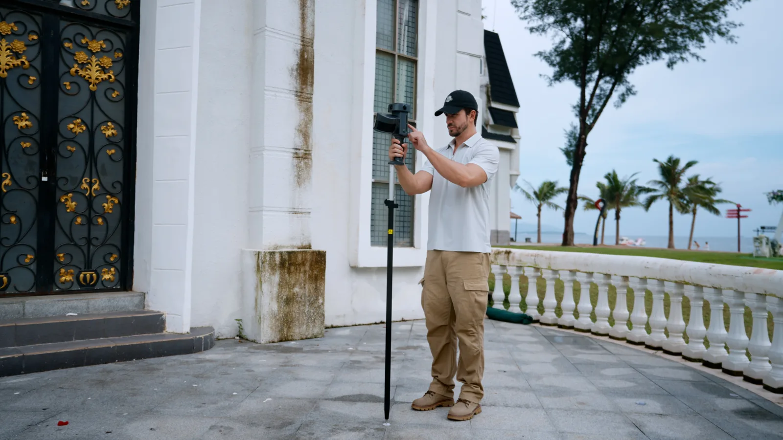
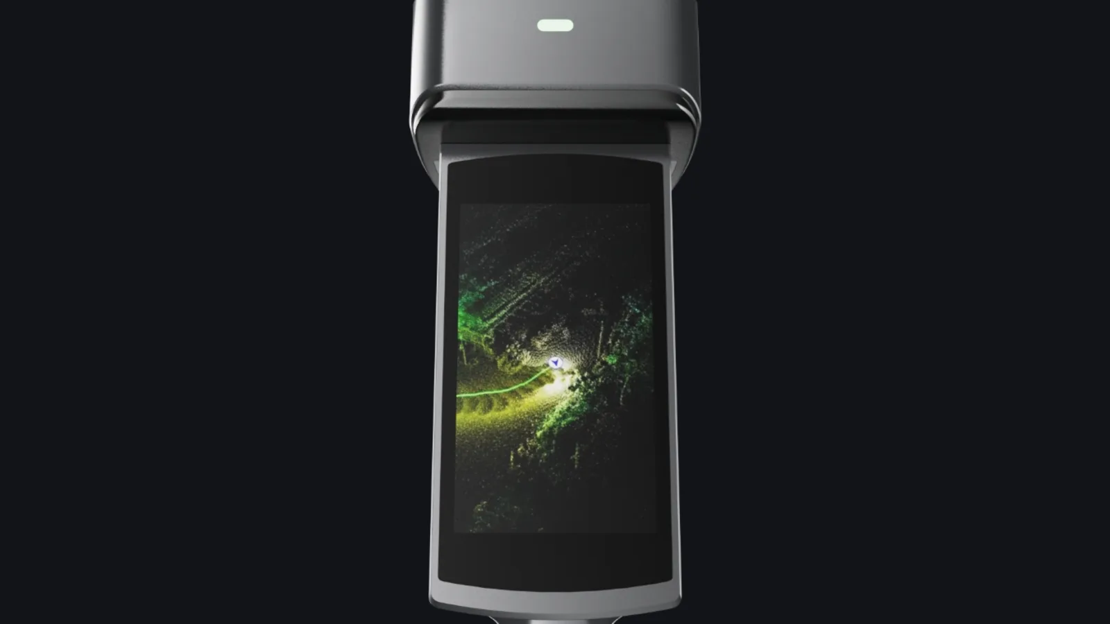
At 2.5 kg this is a two-handed device, or one you hang off the shoulder rig for a long shift. The screen is the real change. Earlier L-series units had none, so checking a scan meant pairing a phone or tablet over Wi-Fi. At 1,000 nits this one stays readable on a rooftop at midday.
IP54 covers dust and splashes, not rain. Nothing in this class is a wet-weather device, so plan around the afternoon storms rather than through them.
On-device and processing features
Some of these change how a capture day runs rather than padding the spec sheet.
- Scan assistance system. Quality checking while you capture. This is the one that saves money, because it catches a failing scan on site instead of back at the office.
- AI dynamic object removal. Strips moving people and vehicles during capture, which matters on occupied floors and live roads.
- AI noise filtering and true-colour point cloud, both in real time.
- On-model measurement and POI panorama preview, taken on the device itself.
- Control-point-free map fusion and multi-session fusion and adjustment, for joining separate visits into one coordinated dataset.
- PPK post-processing, to correct a trajectory afterwards when you had no live RTK link.
- Stable mapping in low-feature environments, aimed at the blank corridors and tunnels where SLAM drifts.
- AI privacy protection, blurring faces and plates. Useful for PDPA obligations when you scan occupied or public space.
- Stockpile volume calculation and comparison, for quarry, landfill and earthworks work.
Output formats
| Point cloud | .las · .rcp · .e57 · .ply · .ilas |
| Imagery | .jpg |
| Mesh | .osgb · .obj |
| 3DGS | .lcc2 · .lcc · .ply |
| Other | 3D Tiles (.3tz) · .usd |
This is a much wider list than the L2 Pro, which publishes .las and .jpg. Two additions earn their place. .rcp is Autodesk ReCap, so the cloud opens in Revit and Civil 3D for Scan-to-BIM with no conversion step and no conversion errors. .e57 is the neutral exchange format nearly every survey and BIM package reads. Beyond that, .usd points at visual effects and simulation work, and 3D Tiles at web and GIS delivery. Our capture methods comparison covers how these outputs differ in practice.
Where the L3 sits in the XGRIDS range
XGRIDS now sells five capture devices: the Lixel K1, the Lixel K2, the Lixel L2 Pro, the Lixel L3 and the PortalCam 3DGS camera. The L3 does not replace the L2 Pro. It is more accurate and better equipped, but it reaches 120 m against the L2 Pro's 300 m version, and XGRIDS has announced no vehicle or drone mounting for it. We go through that properly in Lixel L3 vs Lixel L2 Pro.
Availability, price and what to do now
The L3 launched in Japan first, through XGRIDS' Japanese distributor, with a webinar and a run of hands-on demonstrations through late 2026. There is no published price, no Singapore or Southeast Asia date, and no brochure or manual on the XGRIDS support portal yet. The specification page is currently the only complete first-party source, which is why this guide leans on it.
We are tracking the L3 for the rental fleet and will post Singapore pricing and availability once XGRIDS confirms them. If you have a project running now, the Lixel K2 and the Lixel L2 Pro are on the shelf and handle the same work, and we can also run the capture for you if you would rather not operate the hardware. Tell us what you need to deliver and we will point you at the right option.
Sources
Specifications here come from XGRIDS' own Lixel L3 and Lixel L2 Pro specification pages, retrieved 15 September 2026, with the launch date confirmed by XGRIDS' Japanese distributor announcement of the same day. These are manufacturer claims under the test conditions listed above. We have not measured the device ourselves.