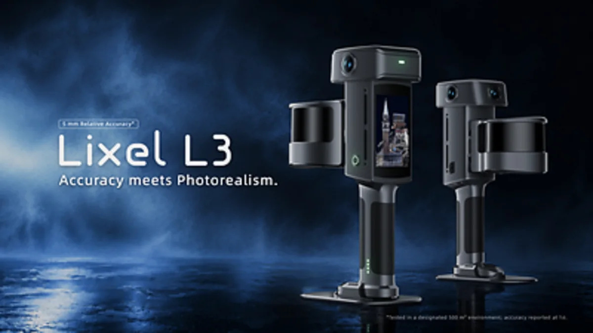
XGRIDS announced the Lixel L3 at INTERGEO 2026 in Munich, describing it as a handheld spatial scanner with validated 5 mm relative accuracy, demonstrated against measured ground truth in a documented test. The unit combines LiDAR, a true-colour vision system, integrated RTK and a 4.3-inch on-board display, and the company states it typically covers around 100 square metres in 10 minutes for high-accuracy data and photorealistic models. XGRIDS also quotes approximately 2.5 cm real-time absolute accuracy, and says the L3 outputs true-colour point clouds, meshes and 3DGS models, with its LCC2 format among the early 3DGS formats supported by established software platforms. The announcement is here.
What this means for 3d scanning services singapore buyers
Two numbers in that release matter, and they are not the same number.
Relative accuracy is how well points sit against each other inside a scan. Absolute accuracy is how well the whole scan sits on a real-world coordinate. XGRIDS quotes 5 mm for the first and about 2.5 cm for the second, in real time. That gap is normal and it is the gap most clients never ask about.
For most as-built work in Singapore, the relative figure is the one that governs whether a wall reads as 100 mm or 105 mm off the column line. The absolute figure governs whether that wall lands in the right place on a survey grid, which matters for site boundaries, GPRS-referenced submissions and any drawing that has to tie into an existing control network.
A handheld scanner with this specification is genuinely useful for the work we do most: M&E plant rooms, ceiling voids, conservation shophouse interiors, retail units before a fit-out, and the messy back-of-house spaces where a tripod scanner needs twenty setups and a handheld needs two passes.
What changes in practice, and what does not
What changes
Handheld SLAM capture has been good enough for visualisation for several years. It has been marginal for dimensional work. A validated 5 mm relative figure, if it holds up outside a controlled test, moves handheld capture into the range where it can carry a Scan-to-BIM deliverable for interiors without a tripod scanner backing it up on every job.
The integrated RTK is the more interesting part for site work. On an open site, real-time absolute positioning at roughly 2.5 cm removes a step: you no longer need to set control points and register to them afterwards just to get the cloud onto a known datum. That is a real time saving on a drone-plus-ground capture job, and it changes how we would sequence a topographic or progress capture.
The 3DGS output is the third piece. Autodesk adding 3DGS support in 3ds Max and Trimble integrating it into SketchUp, both referenced in the release, signal that photorealistic radiance-field outputs are becoming a normal deliverable rather than a novelty. For a client who wants a walkable record of a completed fit-out, that is now a one-capture output rather than a separate photographic exercise. We cover that workflow under digital twin capture.
What does not change
The 5 mm figure is relative accuracy under a documented test. It is not a statement about your project. Registration method, scan overlap, surface reflectivity, how much glass and mirror you walk past, and how long the loop is all move the final number. Any supplier who quotes you 5 mm as a project tolerance without qualification is quoting a brochure.
Long, straight, feature-poor environments remain the weak point of SLAM. A 60-metre corridor with painted walls and no door frames gives any handheld scanner little to lock onto, and drift accumulates. Tripod scanning with targets still wins there, and it will keep winning.
Absolute accuracy at 2.5 cm is not survey-grade. It is fine for progress capture, area verification and most as-built records. It is not fine for boundary determination, setting-out, or anything a registered surveyor has to sign. If your deliverable needs that, you need a surveyor, not a scanner.
The L3 does not change what a point cloud is. It is still a large, unclassified set of points. Turning it into drawings, a Revit model or a federated BIM element set is a separate, skilled job. That is where most project budgets actually go, and no scanner announcement changes it. Our Scan-to-BIM work is priced on that processing, not on the capture hours.
Our view
We rent and sell the Lixel K2, K1 and L2 Pro, so we have an interest here. We also have a reason to be careful about the claim.
The honest position: a validated 5 mm relative accuracy figure from a handheld unit is a meaningful step, and it is the kind of specification that will make handheld capture the default first pass on interior work. It is not a reason to sell your tripod scanner, and it is not a reason to accept a handheld-only quote on a project with tight tolerances or long open runs.
Three things we would want to see before treating this as settled:
How the 5 mm was measured. The release says validated against measured ground truth in a documented test. That is the right kind of language, but the test conditions matter: range, surface, loop length, whether RTK was active, and how registration was done. Until we have run one on a Singapore site, we treat the number as a vendor figure.
How it registers with other data. Most real projects mix handheld, tripod and drone capture. If the L3's registration into a mixed dataset is clean, it slots into our existing workflow. If it needs its own processing chain, the saving is smaller than it looks.
What the LCC2 format costs you downstream. Early support in mainstream platforms is good. Early formats also change. Anyone building a deliverable library on a proprietary 3DGS container should keep the source point cloud and mesh as well, so the record survives a format shift.
Who should care: contractors doing recurring progress capture on the same site, facility teams who want an annual interior record, and interior fit-out firms who scan every unit before demolition. If you capture more than a handful of times a year and you have someone who can process the data, this class of device is worth evaluating. If you have one project, engage a team.
What to do next
If you are commissioning documentation, the question to put to any supplier, us included, is not which scanner they use. It is:
- What relative and absolute accuracy are you committing to for the delivered drawing or model, and under what conditions?
- How was the scan registered, and to what control?
- What is the raw deliverable, and what is the processed deliverable?
We deliver 3D laser scanning and drone and aerial LiDAR with our own team and equipment, and we will tell you when a job does not need us. If you want to run the capture yourself, our equipment rental line covers the Lixel range, PortalCam, Matterport Pro3 and Leica BLK360 G2. On that line you produce your own outputs; we supply the hardware and the handover, not the processing.
For a scoped view of what your project actually needs, request a quote or look at all services. If your interest is in how software changes affect as-built deliverables, our earlier post on Forma replacing Revit covers that side.